Area Overview for LE14 2EF
Photos of LE14 2EF

Area Information
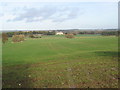
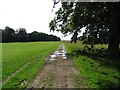
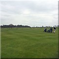
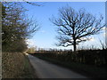
Living in LE14 2EF means inhabiting a small, tightly knit residential cluster in England’s East Midlands. The area spans 95.4 hectares, housing 1,563 people at a density of just 20 people per square kilometre, offering a quiet, low-density lifestyle. This postcode is a modest, family-oriented community, with homes predominantly in private ownership. The area’s character is defined by its proximity to nearby towns and its blend of rural and commuter appeal. Residents benefit from nearby rail links and retail hubs, while the local environment remains unspoiled by major infrastructure. With a median age of 47, the population skews towards adults in their 30s to 60s, suggesting a mature, stable community. The area’s small size means it is not a sprawling suburb but a focused, self-contained neighbourhood. For those seeking a peaceful, low-stress environment with access to essential services, LE14 2EF offers a balance of seclusion and practicality.
- Area Type
- Postcode
- Area Size
- 95.4 hectares
- Population
- 1563
- Population Density
- 20 people/km²
The property market in LE14 2EF is characterised by a 53% home ownership rate, meaning nearly half of the housing stock is privately owned, while the remainder is likely rented. The accommodation type is exclusively houses, which is unusual for areas with higher flat or apartment density. This suggests a traditional, suburban-style housing stock, possibly with larger properties than average. Given the area’s small size—just 95.4 hectares—the housing stock is limited, which may create a competitive market for buyers. The focus on owner-occupation implies a community of long-term residents, though the relatively low home ownership rate also indicates a segment of renters, possibly younger or transient households. Buyers should consider the limited availability of properties and the potential for a tight market, particularly for those seeking specific types of homes.
House Prices in LE14 2EF
No properties found in this postcode.
Energy Efficiency in LE14 2EF
The lifestyle in LE14 2EF is shaped by its proximity to practical amenities. Within reach are five retail outlets, including Tesco Melton, Spar, and Morrisons North Melton, ensuring access to grocery and daily shopping needs. The area’s rail links to Melton Mowbray and Oakham provide connections to larger towns, while RAF Cottesmore adds a layer of regional accessibility. Though the data does not mention parks or leisure facilities, the low population density and absence of planning constraints suggest open spaces may be available nearby. The combination of retail options and transport links supports a convenient, self-sufficient lifestyle. However, the lack of detailed information on leisure or recreational facilities means residents may need to travel further for activities beyond shopping and commuting.
Amenities
Schools
Residents of LE14 2EF have access to two primary schools: Buckminster Primary School and St Peter’s Church of England Primary School Wymondham. The latter is explicitly rated as ‘good’ by Ofsted, offering families a high standard of education. Both schools are primary institutions, which is typical for the area’s demographic profile of adults in their 30s to 60s, many of whom may have children in early education. The presence of two primary schools within practical reach suggests a focus on local schooling, reducing the need for long commutes. However, no secondary schools are listed in the data, meaning families may need to look further afield for secondary education. The mix of schools provides some choice but may not fully meet the needs of households with older children.
| Rank | School | Type | Entry gender | Ages |
|---|
Explore more schools in this area
Go to Schools tabDemographics
The community in LE14 2EF is predominantly composed of adults aged 30 to 64, with a median age of 47. This suggests a mature, established population with likely long-term ties to the area. Home ownership rates stand at 53%, indicating a mix of owner-occupied properties and rental homes. The accommodation type is primarily houses, reflecting a traditional, low-density housing stock. The predominant ethnic group is White, though no specific data on diversity or deprivation is provided. The low population density of 20 people per square kilometre implies a spread-out, less congested living environment. This demographic profile suggests a community focused on stability, with residents likely prioritising family-oriented living and long-term residency over transient or high-turnover lifestyles.
Household Size
Accommodation Type
Tenure
Ethnic Group
Religion
Household Composition
Age
Household Deprivation
NS-SEC
Explore more demographic insights in this area
Go to Demographics tabPlanning
Planning Constraints
- Flood RiskPremium
- Ramsar Wetland SitesPremium
- Area of Outstanding Natural BeautyPremium
- Protected Nature ReservePremium
- Protected WoodlandPremium