Area Overview for LE13 1QF
Photos of LE13 1QF
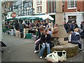


100 photos from this area
Area Information
Key information about the LE13 1QF including its size, population, and administrative classification.
- Area Type
- Postcode
- Area Size
- 1.7 hectares
- Population
- 1785
- Population Density
- 1194 people/km²
House Prices in LE13 1QF
24
Properties
£839,125
Average Sold Price
£57,000
Lowest Price
£8,511,000
Highest Price
Showing 24 properties
| Address | Type | Beds | Baths | Last Sale Price | Last Sale Date | |
|---|---|---|---|---|---|---|
| 52 Kings Road, Melton Mowbray, LE13 1QF | Semi-detached | 4 | 2 | £315,000 | Sep 2025 | |
| 42 Kings Road, Melton Mowbray, LE13 1QF | Terraced | 4 | 2 | £215,000 | Aug 2023 | |
| 21 Kings Road, Melton Mowbray, LE13 1QF | community_day_centre | - | - | £140,000 | Mar 2021 | |
| 44 Kings Road, Melton Mowbray, LE13 1QF | Terraced | 4 | 4 | £8,511,000 | Jan 2021 | |
| 8 Kings Road, Melton Mowbray, LE13 1QF | Semi-detached | 3 | - | £160,000 | Dec 2020 | |
| 56 Kings Road, Melton Mowbray, LE13 1QF | house | 3 | - | £140,000 | Apr 2015 | |
| 34 Kings Road, Melton Mowbray, LE13 1QF | house | 3 | 1 | £91,000 | Jan 2010 | |
| 54 Kings Road, Melton Mowbray, LE13 1QF | Terraced | - | - | £143,000 | Sep 2007 | |
| 38 Kings Road, Melton Mowbray, LE13 1QF | Terraced | - | - | £158,000 | Apr 2006 | |
| 9 Kings Road, Melton Mowbray, LE13 1QF | house | 2 | - | £79,500 | Aug 2003 |
Page 1 of 3
Energy Efficiency in LE13 1QF
Amenities
Schools
| Rank | School | Type | Entry gender | Ages |
|---|
Explore more schools in this area
Go to Schools tabDemographics
Household Size
One person
most common
Accommodation Type
Houses
most common
Tenure
55
majority
Ethnic Group
White
most common
Religion
N/A
most common
Household Composition
N/A
most common
Age
47
median
Adults (30-64 years)
most common
Household Deprivation
N/A
with no deprivation
NS-SEC
27
in Lower managerial occupations
Explore more demographic insights in this area
Go to Demographics tabPlanning
Planning Constraints
- Flood RiskPremium
- Ramsar Wetland SitesPremium
- Area of Outstanding Natural BeautyPremium
- Protected Nature ReservePremium
- Protected WoodlandPremium