Area Overview for LE13 1DD
Photos of LE13 1DD
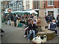


100 photos from this area
Area Information
Key information about the LE13 1DD including its size, population, and administrative classification.
- Area Type
- Postcode
- Area Size
- 2.0 hectares
- Population
- 1785
- Population Density
- 1194 people/km²
House Prices in LE13 1DD
36
Properties
£197,058
Average Sold Price
£100,000
Lowest Price
£281,500
Highest Price
Showing 36 properties
| Address | Type | Beds | Baths | Last Sale Price | Last Sale Date | |
|---|---|---|---|---|---|---|
| 34 Harvey Street, Melton Mowbray, LE13 1DD | house | 3 | 2 | £247,500 | Mar 2025 | |
| 15 Harvey Street, Melton Mowbray, LE13 1DD | house | 3 | 1 | £205,000 | Mar 2025 | |
| 33 Harvey Street, Melton Mowbray, LE13 1DD | house | 4 | 2 | £280,000 | Dec 2024 | |
| 31 Harvey Street, Melton Mowbray, LE13 1DD | Semi-detached | 4 | 1 | £265,000 | Nov 2024 | |
| 25 Harvey Street, Melton Mowbray, LE13 1DD | Terraced | 3 | 2 | £203,000 | Oct 2024 | |
| 28 Harvey Street, Melton Mowbray, LE13 1DD | house | 3 | 2 | £225,000 | Oct 2024 | |
| 21 Harvey Street, Melton Mowbray, LE13 1DD | Terraced | 4 | 1 | £234,000 | Jun 2023 | |
| 8 Harvey Street, Melton Mowbray, LE13 1DD | house | - | - | £240,000 | Jun 2023 | |
| 6 Harvey Street, Melton Mowbray, LE13 1DD | house | 3 | 3 | £232,500 | Dec 2022 | |
| 18 Harvey Street, Melton Mowbray, LE13 1DD | Detached | 4 | 2 | £281,500 | Dec 2022 |
Page 1 of 4
Energy Efficiency in LE13 1DD
Amenities
Schools
| Rank | School | Type | Entry gender | Ages |
|---|
Explore more schools in this area
Go to Schools tabDemographics
Household Size
One person
most common
Accommodation Type
Houses
most common
Tenure
55
majority
Ethnic Group
White
most common
Religion
N/A
most common
Household Composition
N/A
most common
Age
47
median
Adults (30-64 years)
most common
Household Deprivation
N/A
with no deprivation
NS-SEC
27
in Lower managerial occupations
Explore more demographic insights in this area
Go to Demographics tabPlanning
Planning Constraints
- Flood RiskPremium
- Ramsar Wetland SitesPremium
- Area of Outstanding Natural BeautyPremium
- Protected Nature ReservePremium
- Protected WoodlandPremium