Area Overview for LE13 0XR
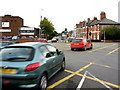
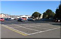
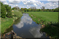
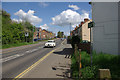
Photos of LE13 0XR


Area Information
Living in LE13 0XR offers a quiet, compact residential experience in a small cluster of homes. With a population of just 1,480, the area feels close-knit, where daily life is shaped by the surrounding countryside and nearby towns. The postcode is primarily composed of houses, reflecting a stable, family-oriented community. Residents benefit from excellent broadband connectivity, scoring 98 out of 100, ensuring seamless internet access for work or leisure. The area’s proximity to Melton Mowbray Railway Station provides practical links to regional transport networks, while nearby supermarkets like Sainsburys Melton and Tesco Nottingham cater to everyday needs. LE13 0XR is ideal for those seeking a low-maintenance lifestyle with minimal environmental constraints, though its small size means it’s best suited for buyers prioritising convenience over sprawling amenities.
- Area Type
- Postcode
- Area Size
- Not available
- Population
- 1480
- Population Density
- 1975 people/km²
The property market in LE13 0XR is characterised by a 53% home ownership rate, suggesting a balance between owner-occupied homes and rental properties. The area’s accommodation is primarily houses, which may appeal to families or those seeking more space than typical flats. Given the small population and limited housing stock, the market is likely to be niche, with properties concentrated in a compact cluster. Buyers should consider the area’s proximity to larger towns for additional amenities, as LE13 0XR itself offers minimal retail or leisure infrastructure. The focus on houses also implies that the area may not be ideal for those seeking modern apartments or high-density living.
House Prices in LE13 0XR
Showing 49 properties
| Address | Type | Beds | Baths | Last Sale Price | Last Sale Date | |
|---|---|---|---|---|---|---|
| 16 Hurricane Close, Melton Mowbray, LE13 0XR | Semi-detached | - | - | - | - | |
| 35 Hurricane Close, Melton Mowbray, LE13 0XR | Detached | - | - | - | - | |
| 22 Hurricane Close, Melton Mowbray, LE13 0XR | Semi-detached | - | - | - | - | |
| 10 Hurricane Close, Melton Mowbray, LE13 0XR | Semi-detached | - | - | - | - | |
| 37 Hurricane Close, Melton Mowbray, LE13 0XR | Detached | - | - | - | - | |
| 12 Hurricane Close, Melton Mowbray, LE13 0XR | Terraced | - | - | - | - | |
| 34 Hurricane Close, Melton Mowbray, LE13 0XR | Detached | - | - | - | - | |
| 26 Hurricane Close, Melton Mowbray, LE13 0XR | Semi-detached | - | - | - | - | |
| 42 Hurricane Close, Melton Mowbray, LE13 0XR | Semi-detached | - | - | - | - | |
| 18 Hurricane Close, Melton Mowbray, LE13 0XR | Flat | - | - | - | - |
Energy Efficiency in LE13 0XR
The lifestyle in LE13 0XR is shaped by its proximity to essential retail and transport hubs. Within practical reach are five notable retail outlets, including Sainsburys Melton, Tesco Nottingham, and Lidl North Melton, ensuring residents have access to grocery shopping and everyday conveniences. The Melton Mowbray Railway Station provides a direct link to regional travel, though the area itself lacks larger leisure or cultural facilities. Daily life here is likely to revolve around local errands and commuting, with the small population fostering a quiet, low-key rhythm. The absence of parks or entertainment venues means residents may need to travel further for leisure, but the retail and transport options make it functional for basic needs.
Amenities
Schools
| Rank | School | Type | Entry gender | Ages |
|---|
Explore more schools in this area
Go to Schools tabDemographics
The community in LE13 0XR is predominantly composed of adults aged 30–64, with a median age of 47. This suggests a mature, established population, likely with strong ties to local institutions and long-term residency. Home ownership stands at 53%, indicating a mix of owner-occupied properties and rental units, though the data does not specify the latter’s proportion. The area’s accommodation is largely houses, which aligns with the demographic profile of older, settled households. The predominant ethnic group is White, though no further breakdown of diversity is provided. The population size—1,480—means the area is small enough to foster familiarity among residents, though it lacks the density of larger urban centres.
Household Size
Accommodation Type
Tenure
Ethnic Group
Religion
Household Composition
Age
Household Deprivation
NS-SEC
Explore more demographic insights in this area
Go to Demographics tabPlanning
Planning Constraints
- Flood RiskPremium
- Ramsar Wetland SitesPremium
- Area of Outstanding Natural BeautyPremium
- Protected Nature ReservePremium
- Protected WoodlandPremium