Area Overview for LE13 0RB
Photos of LE13 0RB
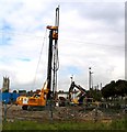
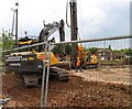
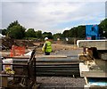
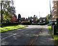
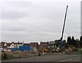
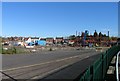
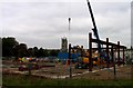
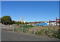
100 photos from this area
Area Information
Key information about the LE13 0RB including its size, population, and administrative classification.
- Area Type
- Postcode
- Area Size
- 1.3 hectares
- Population
- 1845
- Population Density
- 1060 people/km²
House Prices in LE13 0RB
12
Properties
£220,833
Average Sold Price
£130,000
Lowest Price
£342,500
Highest Price
Showing 12 properties
| Address | Type | Beds | Baths | Last Sale Price | Last Sale Date | |
|---|---|---|---|---|---|---|
| 1 Tennis Avenue, Melton Mowbray, LE13 0RB | Bungalow | 3 | - | £275,000 | Sep 2022 | |
| 9 Tennis Avenue, Melton Mowbray, LE13 0RB | Bungalow | - | - | £342,500 | Feb 2022 | |
| 6 Tennis Avenue, Melton Mowbray, LE13 0RB | Bungalow | 3 | - | £225,000 | May 2019 | |
| 4 Tennis Avenue, Melton Mowbray, LE13 0RB | Bungalow | 2 | - | £130,000 | Mar 2011 | |
| 5 Tennis Avenue, Melton Mowbray, LE13 0RB | Bungalow | - | - | £171,000 | Oct 2009 | |
| 2 Tennis Avenue, Melton Mowbray, LE13 0RB | Detached | - | - | £246,000 | Aug 2007 | |
| 3 Tennis Avenue, Melton Mowbray, LE13 0RB | Semi-detached | - | - | £143,000 | May 2006 | |
| 7 Tennis Avenue, Melton Mowbray, LE13 0RB | Bungalow | - | - | £230,000 | Mar 2005 | |
| 8 Tennis Avenue, Melton Mowbray, LE13 0RB | Detached | - | - | £225,000 | Sep 2003 | |
| Tennis 28M From Hamilton Lawn Tennis Club, Tennis Avenue 15M From Tennis Avenue, Tennis Avenue, Melton Mowbray, LE13 0RB | Leisure | - | - | - | - |
Page 1 of 2
Energy Efficiency in LE13 0RB
Amenities
Schools
| Rank | School | Type | Entry gender | Ages |
|---|
Explore more schools in this area
Go to Schools tabDemographics
Household Size
Two person
most common
Accommodation Type
Houses
most common
Tenure
66
majority
Ethnic Group
White
most common
Religion
N/A
most common
Household Composition
N/A
most common
Age
47
median
Adults (30-64 years)
most common
Household Deprivation
N/A
with no deprivation
NS-SEC
22
in Lower managerial occupations
Explore more demographic insights in this area
Go to Demographics tabPlanning
Planning Constraints
- Flood RiskPremium
- Ramsar Wetland SitesPremium
- Area of Outstanding Natural BeautyPremium
- Protected Nature ReservePremium
- Protected WoodlandPremium