Area Overview for LE13 0BW
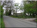
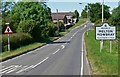
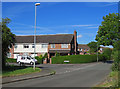
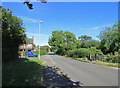
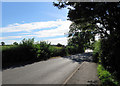
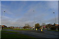
Photos of LE13 0BW


Area Information
LE13 0BW is a compact, residential postcode area in England, covering just 18.4 hectares and home to 1,650 people. Its high population density of 8,963 people per square kilometre reflects a tightly knit community. This is a small, focused area where daily life revolves around local amenities and proximity to essential services. The area is predominantly occupied by adults aged 30–64, with a median age of 47, suggesting a mature, stable population. Home ownership is strong, with 72% of residents owning their homes, indicating a long-term presence in the area. The low crime risk score of 79 and minimal environmental hazards, such as no flood risk or protected natural sites, make it an appealing choice for families and professionals seeking safety and convenience. Nearby, Melton Mowbray Railway Station offers rail access, while local shops and a primary school provide practical resources. The area’s small size means it is ideal for those prioritising proximity to services and a close-knit environment.
- Area Type
- Postcode
- Area Size
- 18.4 hectares
- Population
- 1650
- Population Density
- 1833 people/km²
The property market in LE13 0BW is characterised by a high rate of home ownership (72%) and a predominance of houses over other property types. This suggests a market skewed towards owner-occupied homes rather than rentals, likely reflecting the area’s appeal to families and long-term residents. The compact size of the postcode area, just 18.4 hectares, means the housing stock is limited, potentially creating a competitive environment for buyers. The focus on houses implies a demand for larger, family-friendly properties, which may influence property values and development opportunities in the surrounding areas. For buyers, this small area offers a clear advantage in terms of proximity to amenities and schools, though the limited size may restrict availability. The high home ownership rate also indicates a stable market, with fewer fluctuations in property prices compared to more transient areas.
House Prices in LE13 0BW
No properties found in this postcode.
Energy Efficiency in LE13 0BW
The lifestyle in LE13 0BW is shaped by its proximity to practical amenities. Within reach are five retail outlets, including Spar, Aldi South Melton, and M&S Egerton Park BP, offering everyday shopping needs. The Melton Mowbray Railway Station provides access to rail services, facilitating travel to larger towns and cities. While the data does not mention parks or leisure facilities, the presence of Swallowdale Primary School and Community Centre suggests opportunities for social engagement and community activities. The compact size of the area means residents can access these amenities without long commutes. The combination of retail, transport, and educational resources contributes to a convenient, self-contained lifestyle. The area’s focus on practicality and proximity to services makes it suitable for those prioritising ease of access over expansive recreational spaces.
Amenities
Schools
The primary school nearest to LE13 0BW is Swallowdale Primary School and Community Centre, which serves the local community with both educational and social services. The school holds a ‘good’ Ofsted rating, indicating a satisfactory standard of education and facilities. As a primary school, it caters to younger children, making it a crucial resource for families in the area. The inclusion of a community centre suggests additional amenities such as community events or shared spaces, which can enhance local cohesion. While no secondary schools are listed in the data, the presence of a well-rated primary school is a significant draw for families prioritising education. The school’s proximity to homes in LE13 0BW ensures ease of access, reducing commuting times for parents and students alike.
| Rank | School | Type | Entry gender | Ages |
|---|
Explore more schools in this area
Go to Schools tabDemographics
The community in LE13 0BW is defined by its age profile and home ownership patterns. With a median age of 47 and the majority of residents falling within the 30–64 age range, this is a mature, family-oriented area. Home ownership is high at 72%, with most properties being houses rather than flats or other accommodation types. The predominant ethnic group is White, reflecting a homogenous demographic. The data does not specify further diversity metrics, but the age range suggests a mix of working professionals and families with children. This demographic structure supports a stable local economy and community cohesion. The high home ownership rate indicates a long-term commitment to the area, which can influence property values and local services. The absence of detailed deprivation data means that while the area appears to have a consistent quality of life, further insights into socioeconomic diversity are not available.
Household Size
Accommodation Type
Tenure
Ethnic Group
Religion
Household Composition
Age
Household Deprivation
NS-SEC
Explore more demographic insights in this area
Go to Demographics tabPlanning
Planning Constraints
- Flood RiskPremium
- Ramsar Wetland SitesPremium
- Area of Outstanding Natural BeautyPremium
- Protected Nature ReservePremium
- Protected WoodlandPremium