Area Overview for LE13 0BG
Photos of LE13 0BG
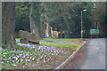
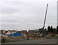
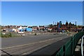
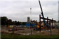
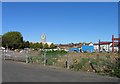
100 photos from this area
Area Information
Key information about the LE13 0BG including its size, population, and administrative classification.
- Area Type
- Postcode
- Area Size
- 7.6 hectares
- Population
- 1845
- Population Density
- 1060 people/km²
House Prices in LE13 0BG
24
Properties
£265,656
Average Sold Price
£111,500
Lowest Price
£405,000
Highest Price
Showing 24 properties
| Address | Type | Beds | Baths | Last Sale Price | Last Sale Date | |
|---|---|---|---|---|---|---|
| 35 Dalby Road, Melton Mowbray, LE13 0BG | Detached | 3 | 1 | £405,000 | Jul 2024 | |
| Ground Floor Flat, 25A Dalby Road, Melton Mowbray, LE13 0BG | Flat | - | - | £255,000 | Aug 2020 | |
| 27A Dalby Road, Melton Mowbray, LE13 0BG | house | - | - | £375,000 | May 2019 | |
| 23 Dalby Road, Melton Mowbray, LE13 0BG | house | 3 | 2 | £177,000 | Feb 2018 | |
| 43 Dalby Road, Melton Mowbray, LE13 0BG | house | - | - | £300,000 | Jul 2016 | |
| Ravenhead, 29 Dalby Road, Melton Mowbray, LE13 0BG | house | - | - | £362,000 | Feb 2016 | |
| 51 Dalby Road, Melton Mowbray, LE13 0BG | Detached | 4 | - | £275,000 | Dec 2013 | |
| 49 Dalby Road, Melton Mowbray, LE13 0BG | Detached | 4 | 1 | £239,000 | Dec 2013 | |
| 53 Dalby Road, Melton Mowbray, LE13 0BG | Detached | - | - | £342,500 | Aug 2012 | |
| 61 Dalby Road, Melton Mowbray, LE13 0BG | house | - | - | £320,000 | Sep 2011 |
Page 1 of 3
Energy Efficiency in LE13 0BG
Amenities
Schools
| Rank | School | Type | Entry gender | Ages |
|---|
Explore more schools in this area
Go to Schools tabDemographics
Household Size
Two person
most common
Accommodation Type
Houses
most common
Tenure
66
majority
Ethnic Group
White
most common
Religion
N/A
most common
Household Composition
N/A
most common
Age
47
median
Adults (30-64 years)
most common
Household Deprivation
N/A
with no deprivation
NS-SEC
22
in Lower managerial occupations
Explore more demographic insights in this area
Go to Demographics tabPlanning
Planning Constraints
- Flood RiskPremium
- Ramsar Wetland SitesPremium
- Area of Outstanding Natural BeautyPremium
- Protected Nature ReservePremium
- Protected WoodlandPremium