Area Overview for LE12 9UY
Photos of LE12 9UY
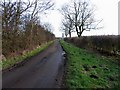
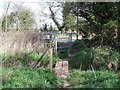
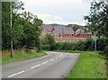
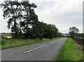
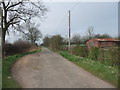
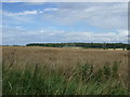
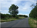
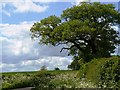
16 photos from this area
Area Information
Key information about the LE12 9UY including its size, population, and administrative classification.
- Area Type
- Postcode
- Area Size
- 9.8 hectares
- Population
- 2007
- Population Density
- 466 people/km²
House Prices in LE12 9UY
33
Properties
£269,502
Average Sold Price
£131,250
Lowest Price
£472,240
Highest Price
Showing 33 properties
| Address | Type | Beds | Baths | Last Sale Price | Last Sale Date | |
|---|---|---|---|---|---|---|
| 47 Lenton Road, Shepshed, LE12 9UY | Semi-detached | 3 | 2 | £245,000 | Nov 2023 | |
| 53 Lenton Road, Shepshed, LE12 9UY | house | - | - | £374,950 | Feb 2022 | |
| 41 Lenton Road, Shepshed, LE12 9UY | house | - | - | £399,950 | Jan 2022 | |
| 55 Lenton Road, Shepshed, LE12 9UY | Detached | 4 | 3 | £374,950 | Dec 2021 | |
| 57 Lenton Road, Shepshed, LE12 9UY | house | - | - | £275,000 | Aug 2021 | |
| 51 Lenton Road, Shepshed, LE12 9UY | house | - | - | £379,950 | Jul 2021 | |
| 39 Lenton Road, Shepshed, LE12 9UY | house | - | - | £274,950 | Mar 2021 | |
| 49 Lenton Road, Shepshed, LE12 9UY | house | - | - | £469,950 | Mar 2021 | |
| 45 Lenton Road, Shepshed, LE12 9UY | house | - | - | £204,950 | Feb 2021 | |
| 35 Lenton Road, Shepshed, LE12 9UY | house | - | - | £304,950 | Feb 2021 |
Page 1 of 4
Energy Efficiency in LE12 9UY
Amenities
Schools
| Rank | School | Type | Entry gender | Ages |
|---|
Explore more schools in this area
Go to Schools tabDemographics
Household Size
Two person
most common
Accommodation Type
Houses
most common
Tenure
63
majority
Ethnic Group
White
most common
Religion
N/A
most common
Household Composition
N/A
most common
Age
47
median
Adults (30-64 years)
most common
Household Deprivation
N/A
with no deprivation
NS-SEC
30
in Lower managerial occupations
Explore more demographic insights in this area
Go to Demographics tabPlanning
Planning Constraints
- Flood RiskPremium
- Ramsar Wetland SitesPremium
- Area of Outstanding Natural BeautyPremium
- Protected Nature ReservePremium
- Protected WoodlandPremium