Area Overview for LE12 9EQ
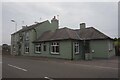
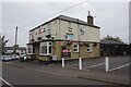
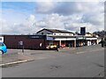
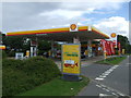
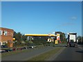
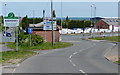
Photos of LE12 9EQ


Area Information
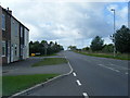
LE12 9EQ is a small residential cluster in England, covering 9,762 square metres and home to 1,497 residents. The area is defined by its compact size and the presence of established housing, with 70% of homes owned by residents rather than rented. Daily life here is shaped by its proximity to practical amenities, including two metro stations, a railway link to Loughborough, and nearby supermarkets like Tesco and Aldi. The population, predominantly adults aged 30–64, reflects a mature community with a median age of 47. While the area lacks natural or protected landscapes, its low flood risk and average crime rates make it a stable, if unremarkable, place to live. The broadband score of 99 ensures seamless digital connectivity, supporting both work and leisure. For those seeking a quiet, functional neighbourhood with straightforward access to transport and retail, LE12 9EQ offers a no-frills lifestyle. However, its small size means the housing stock is limited, and buyers should consider the area’s modest scale when evaluating long-term potential.
- Area Type
- Postcode
- Area Size
- 9762 m²
- Population
- 1497
- Population Density
- 265 people/km²
The property market in LE12 9EQ is characterised by high home ownership (70%) and a predominance of houses. This suggests a community of long-term residents rather than a transient rental market. The small area size means the housing stock is limited, which may affect availability for buyers. The focus on owner-occupied properties indicates a preference for stability, though the lack of data on property prices or recent developments means buyers should conduct local inspections. The proximity to Loughborough Railway Station and nearby retail hubs like Tesco and Co-op adds practical value, but the area’s modest scale means buyers must consider the surrounding regions for more options. For those prioritising security and a low-risk environment, LE12 9EQ’s housing market offers a straightforward, if unexciting, proposition.
House Prices in LE12 9EQ
Showing 1 properties
| Address | Type | Beds | Baths | Last Sale Price | Last Sale Date | |
|---|---|---|---|---|---|---|
| Former 67, Ashby Road Central, Shepshed, LE12 9EQ | Detached | - | - | - | - |
Energy Efficiency in LE12 9EQ
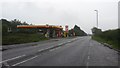
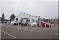
Residents of LE12 9EQ have access to a range of practical amenities within walking or short driving distance. Retail options include Aldi on Fairway Road South, Co-op Anson, and Tesco in Shepshed, providing essential shopping and food services. The area’s transport links, including Loughborough Railway Station and nearby metro stops, support easy access to larger towns and cities. While there is no mention of parks or leisure facilities in the data, the presence of multiple retail outlets and transport hubs suggests a lifestyle focused on convenience rather than recreation. The proximity to East Midlands Airport also caters to those requiring frequent travel. For buyers prioritising accessibility over scenic amenities, LE12 9EQ offers a straightforward, functional lifestyle with minimal need for long-distance travel.
Amenities
Schools
| Rank | School | Type | Entry gender | Ages |
|---|
Explore more schools in this area
Go to Schools tabDemographics
The population of LE12 9EQ is 1,497, with a median age of 47. The majority of residents fall within the 30–64 age range, reflecting a mature, established community. Home ownership is high at 70%, indicating a stable demographic with long-term residency. The accommodation type is predominantly houses, suggesting a mix of family homes and single-occupancy properties. The predominant ethnic group is White, with no specific data provided on other ethnicities. The population density of 265 people per square kilometre is moderate, balancing space and proximity to amenities. While the area lacks detailed diversity metrics, the age profile and ownership figures suggest a community focused on stability rather than rapid change. This demographic profile aligns with a low-risk environment, though the average crime score of 58/100 indicates standard precautions are advisable.
Household Size
Accommodation Type
Tenure
Ethnic Group
Religion
Household Composition
Age
Household Deprivation
NS-SEC
Explore more demographic insights in this area
Go to Demographics tabPlanning
Planning Constraints
- Flood RiskPremium
- Ramsar Wetland SitesPremium
- Area of Outstanding Natural BeautyPremium
- Protected Nature ReservePremium
- Protected WoodlandPremium