Area Overview for LE12 8UG
Photos of LE12 8UG
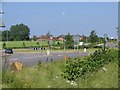
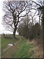
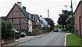


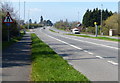


52 photos from this area
Area Information
Key information about the LE12 8UG including its size, population, and administrative classification.
- Area Type
- Postcode
- Area Size
- 52.5 hectares
- Population
- 1578
- Population Density
- 1647 people/km²
House Prices in LE12 8UG
25
Properties
£479,964
Average Sold Price
£170,000
Lowest Price
£730,000
Highest Price
Showing 25 properties
| Address | Type | Beds | Baths | Last Sale Price | Last Sale Date | |
|---|---|---|---|---|---|---|
| Fletchers Farmhouse, 43 Main Street, Woodthorpe, Loughborough, LE12 8UG | Detached | 4 | 2 | £620,000 | Nov 2024 | |
| Campbell Cottage, 60 Main Street, Woodthorpe, Loughborough, LE12 8UG | Terraced | 2 | 2 | £705,000 | Jul 2023 | |
| 21 Main Street, Woodthorpe, Loughborough, LE12 8UG | house | - | - | £530,000 | Oct 2021 | |
| The Grange, 71 Main Street, Woodthorpe, Loughborough, LE12 8UG | house | - | - | £685,000 | Jun 2021 | |
| 58 Main Street, Woodthorpe, Loughborough, LE12 8UG | Terraced | 2 | - | £272,500 | May 2021 | |
| Kilve, 66 Main Street, Woodthorpe, Loughborough, LE12 8UG | house | - | - | £450,000 | Aug 2020 | |
| 48 Main Street, Woodthorpe, Loughborough, LE12 8UG | Detached | 4 | 3 | £425,000 | Mar 2020 | |
| Grange Farm Bungalow, 63 Main Street, Woodthorpe, Loughborough, LE12 8UG | Bungalow | 2 | 1 | £425,000 | Apr 2019 | |
| 42 Main Street, Woodthorpe, Loughborough, LE12 8UG | Detached | 2 | - | £330,000 | Oct 2018 | |
| The Old Barn, 45 Main Street, Woodthorpe, Loughborough, LE12 8UG | house | - | - | £500,000 | Feb 2017 |
Page 1 of 3
Energy Efficiency in LE12 8UG
Amenities
Schools
| Rank | School | Type | Entry gender | Ages |
|---|
Explore more schools in this area
Go to Schools tabDemographics
Household Size
Family (3-5 people)
most common
Accommodation Type
Houses
most common
Tenure
82
majority
Ethnic Group
White
most common
Religion
N/A
most common
Household Composition
N/A
most common
Age
47
median
Adults (30-64 years)
most common
Household Deprivation
N/A
with no deprivation
NS-SEC
50
in Lower managerial occupations
Explore more demographic insights in this area
Go to Demographics tabPlanning
Planning Constraints
- Flood RiskPremium
- Ramsar Wetland SitesPremium
- Area of Outstanding Natural BeautyPremium
- Protected Nature ReservePremium
- Protected WoodlandPremium