Area Overview for LE12 8PJ
Photos of LE12 8PJ

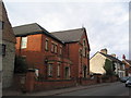
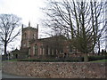
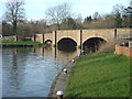
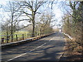
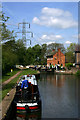
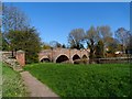
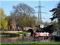
100 photos from this area
Area Information
Key information about the LE12 8PJ including its size, population, and administrative classification.
- Area Type
- Postcode
- Area Size
- 3.0 hectares
- Population
- 2486
- Population Density
- 412 people/km²
House Prices in LE12 8PJ
55
Properties
£199,846
Average Sold Price
£59,000
Lowest Price
£367,000
Highest Price
Showing 55 properties
| Address | Type | Beds | Baths | Last Sale Price | Last Sale Date | |
|---|---|---|---|---|---|---|
| 62 Beaumont Road, Barrow Upon Soar, LE12 8PJ | Detached | 3 | 1 | £276,000 | Jan 2025 | |
| 56 Beaumont Road, Barrow Upon Soar, LE12 8PJ | house | - | - | £335,000 | May 2024 | |
| 36 Beaumont Road, Barrow Upon Soar, LE12 8PJ | Semi-detached | 3 | 1 | £285,000 | Mar 2023 | |
| 46 Beaumont Road, Barrow Upon Soar, LE12 8PJ | house | - | - | £325,000 | Aug 2022 | |
| Fiddlers Green, 78 Beaumont Road, Barrow Upon Soar, LE12 8PJ | Detached | 4 | 2 | £265,000 | Mar 2021 | |
| 20 Beaumont Road, Barrow Upon Soar, LE12 8PJ | Semi-detached | 3 | - | £315,000 | Jan 2021 | |
| 6 Beaumont Road, Barrow Upon Soar, LE12 8PJ | Detached | 5 | 2 | £367,000 | Nov 2020 | |
| 82 Beaumont Road, Barrow Upon Soar, LE12 8PJ | Semi-detached | 3 | 1 | £235,000 | Aug 2020 | |
| 16 Beaumont Road, Barrow Upon Soar, LE12 8PJ | Semi-detached | 3 | 1 | £220,000 | Apr 2019 | |
| 4 Beaumont Road, Barrow Upon Soar, LE12 8PJ | house | - | - | £242,000 | Jan 2019 |
Page 1 of 6
Energy Efficiency in LE12 8PJ
Amenities
Schools
| Rank | School | Type | Entry gender | Ages |
|---|
Explore more schools in this area
Go to Schools tabDemographics
Household Size
Family (3-5 people)
most common
Accommodation Type
Houses
most common
Tenure
85
majority
Ethnic Group
White
most common
Religion
N/A
most common
Household Composition
N/A
most common
Age
47
median
Adults (30-64 years)
most common
Household Deprivation
N/A
with no deprivation
NS-SEC
49
in Lower managerial occupations
Explore more demographic insights in this area
Go to Demographics tabPlanning
Planning Constraints
- Flood RiskPremium
- Ramsar Wetland SitesPremium
- Area of Outstanding Natural BeautyPremium
- Protected Nature ReservePremium
- Protected WoodlandPremium