Area Overview for LE12 8AA
Photos of LE12 8AA
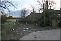
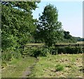
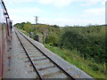
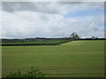
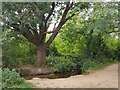
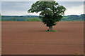
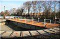
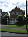
21 photos from this area
Area Information
Key information about the LE12 8AA including its size, population, and administrative classification.
- Area Type
- Postcode
- Area Size
- 38.3 hectares
- Population
- 1706
- Population Density
- 529 people/km²
House Prices in LE12 8AA
26
Properties
£790,913
Average Sold Price
£230,000
Lowest Price
£2,190,000
Highest Price
Showing 26 properties
| Address | Type | Beds | Baths | Last Sale Price | Last Sale Date | |
|---|---|---|---|---|---|---|
| 23 Buddon Lane, Quorn, LE12 8AA | Detached | 5 | 4 | £527,000 | Apr 2024 | |
| 21 Buddon Lane, Quorn, LE12 8AA | Detached | 5 | 4 | £876,000 | Oct 2022 | |
| Carlton House, 20 Buddon Lane, Quorn, LE12 8AA | Detached | 4 | 3 | £925,000 | Mar 2022 | |
| Whitelodge, 22 Buddon Lane, Quorn, LE12 8AA | Detached | 6 | 6 | £2,190,000 | Jul 2020 | |
| 7A Buddon Lane, Quorn, LE12 8AA | Bungalow | 3 | 1 | £500,000 | Sep 2019 | |
| The Paddock, 6 Buddon Lane, Quorn, LE12 8AA | house | - | - | £1,400,000 | Feb 2018 | |
| Woodbine Cottage, 11 Buddon Lane, Quorn, LE12 8AA | Detached | 7 | 4 | £855,000 | Sep 2017 | |
| 3 Buddon Lane, Quorn, LE12 8AA | Detached | 4 | 2 | £711,000 | Jul 2017 | |
| 9 Buddon Lane, Quorn, LE12 8AA | Bungalow | 3 | 2 | £480,000 | Jun 2017 | |
| 18 Buddon Lane, Quorn, LE12 8AA | house | - | - | £1,100,000 | Jan 2010 |
Page 1 of 3
Energy Efficiency in LE12 8AA
Amenities
Schools
| Rank | School | Type | Entry gender | Ages |
|---|
Explore more schools in this area
Go to Schools tabDemographics
Household Size
Two person
most common
Accommodation Type
Houses
most common
Tenure
93
majority
Ethnic Group
White
most common
Religion
N/A
most common
Household Composition
N/A
most common
Age
47
median
Adults (30-64 years)
most common
Household Deprivation
N/A
with no deprivation
NS-SEC
54
in Lower managerial occupations
Explore more demographic insights in this area
Go to Demographics tabPlanning
Planning Constraints
- Flood RiskPremium
- Ramsar Wetland SitesPremium
- Area of Outstanding Natural BeautyPremium
- Protected Nature ReservePremium
- Protected WoodlandPremium