Area Overview for LE12 7UY
Photos of LE12 7UY
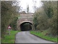
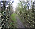
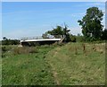
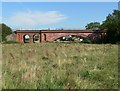
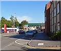
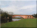
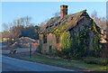
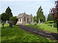
63 photos from this area
Area Information
Key information about the LE12 7UY including its size, population, and administrative classification.
- Area Type
- Postcode
- Area Size
- 4882 m²
- Population
- 1851
- Population Density
- 553 people/km²
House Prices in LE12 7UY
15
Properties
£179,800
Average Sold Price
£107,000
Lowest Price
£265,000
Highest Price
Showing 15 properties
| Address | Type | Beds | Baths | Last Sale Price | Last Sale Date | |
|---|---|---|---|---|---|---|
| 1 Woodward Close, Mountsorrel, LE12 7UY | Semi-detached | 3 | 2 | £265,000 | Feb 2023 | |
| 2 Woodward Close, Mountsorrel, LE12 7UY | Terraced | 3 | 2 | £245,000 | Jul 2022 | |
| 10 Woodward Close, Mountsorrel, LE12 7UY | Semi-detached | 3 | 2 | £227,000 | Aug 2021 | |
| 9 Woodward Close, Mountsorrel, LE12 7UY | Semi-detached | 2 | 1 | £187,000 | Aug 2021 | |
| 3 Woodward Close, Mountsorrel, LE12 7UY | house | - | - | £225,000 | Jun 2021 | |
| 8 Woodward Close, Mountsorrel, LE12 7UY | Bungalow | 2 | 1 | £151,000 | May 2018 | |
| 12 Woodward Close, Mountsorrel, LE12 7UY | Semi-detached | 3 | 2 | £195,000 | Jan 2018 | |
| 7 Woodward Close, Mountsorrel, LE12 7UY | Semi-detached | 1 | 3 | £189,000 | Dec 2016 | |
| 16 Woodward Close, Mountsorrel, LE12 7UY | Semi-detached | 3 | 1 | £183,000 | Nov 2016 | |
| 6 Woodward Close, Mountsorrel, LE12 7UY | house | 3 | - | £177,000 | Aug 2015 |
Page 1 of 2
Energy Efficiency in LE12 7UY
Amenities
Schools
| Rank | School | Type | Entry gender | Ages |
|---|
Explore more schools in this area
Go to Schools tabDemographics
Household Size
Two person
most common
Accommodation Type
Houses
most common
Tenure
67
majority
Ethnic Group
White
most common
Religion
N/A
most common
Household Composition
N/A
most common
Age
47
median
Adults (30-64 years)
most common
Household Deprivation
N/A
with no deprivation
NS-SEC
42
in Lower managerial occupations
Explore more demographic insights in this area
Go to Demographics tabPlanning
Planning Constraints
- Flood RiskPremium
- Ramsar Wetland SitesPremium
- Area of Outstanding Natural BeautyPremium
- Protected Nature ReservePremium
- Protected WoodlandPremium