Area Overview for LE12 7BQ
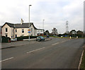
Photos of LE12 7BQ
Area Information
Living in LE12 7BQ means being part of a tightly knit residential cluster in England, where 1,851 people reside across 4,581 square metres. The area’s compact size fosters a sense of community, with a population density of 553 people per square kilometre. This postcode is characterised by a mature demographic, with a median age of 47 and a majority of residents aged between 30 and 64. The presence of independent and special schools nearby, such as Joint Responsibility Preparatory School and Homefield College, suggests a focus on education. Daily life here balances local amenities with easy access to transport networks, including rail and metro services. While the area is small, its proximity to multiple railway stations and retail hubs like Waitrose Mountsorrel and Co-op Mountsorrel ensures practicality for residents. LE12 7BQ is not a sprawling suburb but a defined space where homes, schools, and services are closely interwoven.
- Area Type
- Postcode
- Area Size
- 4581 m²
- Population
- 1851
- Population Density
- 553 people/km²
The property market in LE12 7BQ is largely owner-occupied, with 67% of homes owned by residents rather than rented. This suggests a stable, long-term demographic with a preference for private housing. The accommodation type is predominantly houses, which is typical of smaller residential clusters where larger properties dominate. This configuration may appeal to families seeking space and privacy, though the area’s compact size means buyers must consider the immediate surroundings for additional options. The high home ownership rate also implies limited rental availability, which could affect those seeking short-term accommodation. For those prioritising property stability, LE12 7BQ offers a mix of established homes in a low-density setting, though the small postcode area may limit variety in housing stock.
House Prices in LE12 7BQ
Showing 1 properties
| Address | Type | Beds | Baths | Last Sale Price | Last Sale Date | |
|---|---|---|---|---|---|---|
| City Transair, 58 Loughborough Road, Mountsorrel, LE12 7BQ | office_workshop | - | - | - | - |
Energy Efficiency in LE12 7BQ
The lifestyle in LE12 7BQ is supported by a range of nearby amenities, including five retail outlets such as Waitrose Mountsorrel and Co-op Mountsorrel, which provide essential shopping and dining options. The area’s transport links also grant access to broader leisure opportunities, with metro and rail stations connecting to cultural hubs and recreational spaces. While the data does not specify parks or leisure facilities directly, the presence of multiple retail and transport points suggests a practical, community-focused environment. Residents benefit from a balance between local convenience and regional connectivity, ensuring daily needs are met without the need for long commutes. This blend of accessibility and small-scale living defines the character of LE12 7BQ.
Amenities
Schools
Residents of LE12 7BQ have access to two distinct educational institutions: Joint Responsibility Preparatory School, an independent school, and Homefield College, a special school. The presence of both types suggests a diverse educational landscape, catering to both mainstream and specialist needs. Independent schools often offer smaller class sizes and tailored curricula, while special schools provide support for students with specific learning requirements. For families, this mix ensures flexibility, whether they prioritise traditional schooling or require specialist resources. The proximity of these institutions to homes in LE12 7BQ reduces commuting times, making the area appealing for parents. However, the absence of state schools in the data means buyers should verify if additional options exist within a reasonable distance.
| Rank | School | Type | Entry gender | Ages |
|---|
Explore more schools in this area
Go to Schools tabDemographics
The community in LE12 7BQ is predominantly composed of adults aged 30 to 64, with a median age of 47. This suggests a population of established professionals and families, rather than a transient demographic. Home ownership is high, at 67%, indicating a stable housing market where most residents live in their own homes. The accommodation type is primarily houses, reflecting a suburban or semi-rural character. The predominant ethnic group is White, though specific diversity data is not provided. The population density of 553 people per square kilometre implies a moderate level of urbanisation, balancing residential space with community proximity. For buyers, this profile suggests a mature, low-turnover area where property values may reflect long-term occupancy and local investment.
Household Size
Accommodation Type
Tenure
Ethnic Group
Religion
Household Composition
Age
Household Deprivation
NS-SEC
Explore more demographic insights in this area
Go to Demographics tabPlanning
Planning Constraints
- Flood RiskPremium
- Ramsar Wetland SitesPremium
- Area of Outstanding Natural BeautyPremium
- Protected Nature ReservePremium
- Protected WoodlandPremium