Area Overview for LE12 6TP
Photos of LE12 6TP


Area Information
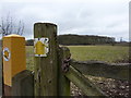
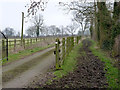
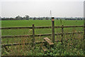
Living in LE12 6TP offers a quiet, residential experience in a small cluster of homes. With a population of 2,223 and a density of 59 people per square kilometre, this area feels uncluttered, avoiding the congestion of larger towns. The community is predominantly composed of adults aged 30–64, reflecting a mature demographic. Daily life here is shaped by proximity to essential services, including two railway stations and a metro stop, ensuring easy access to nearby towns. The area’s low crime risk score of 93/100 and minimal environmental constraints, such as no protected woodlands or wetlands, contribute to a sense of stability. Families benefit from a selection of schools, including two Ofsted-rated ‘good’ primary schools, while the predominantly owner-occupied housing stock suggests long-term residency. LE12 6TP is ideal for those seeking a balanced blend of practicality and safety, with homes primarily in single-family structures. Its compact size means amenities are within practical reach, though it remains distinct from more densely populated regions.
- Area Type
- Postcode
- Area Size
- Not available
- Population
- 2223
- Population Density
- 59 people/km²
The property market in LE12 6TP is characterised by high home ownership, with 87% of residents living in owner-occupied homes. This suggests a community of long-term residents rather than a rental-focused area. The accommodation type is predominantly houses, which is unusual for a small postcode area but aligns with the lower population density of 59 people per square kilometre. This housing stock likely includes semi-detached and detached properties, typical of suburban or rural settings. Buyers should note that the small size of the area means the housing stock is limited, and opportunities for new builds may be constrained. The proximity to nearby towns via rail and metro links could make this area attractive for commuters, though the local market is likely to be more about retaining existing properties than rapid turnover.
House Prices in LE12 6TP
No properties found in this postcode.
Energy Efficiency in LE12 6TP
The lifestyle in LE12 6TP is shaped by its proximity to essential amenities. Local retail options include Morrisons Daily, Co-op Keyworth, and other nearby stores, providing access to groceries and daily necessities. The two railway stations and metro stop ensure easy travel to larger towns for more extensive shopping or dining. While the area lacks large leisure facilities, its quiet residential character offers a contrast to busier centres. The presence of schools and low crime rates contributes to a family-friendly environment. Residents benefit from a mix of convenience and simplicity, with amenities within practical reach but not overwhelming. The area’s small size means it’s ideal for those prioritising safety, stability, and proximity to transport, though it may not suit those requiring a dense array of cultural or recreational options.
Amenities
Schools
Residents of LE12 6TP have access to a range of school options. Willow Brook Primary School and Willoughby Primary School both hold ‘good’ Ofsted ratings, offering reliable primary education. For independent schooling, Plumtree School provides an alternative, while Beech Trees School caters to special educational needs. This mix of school types ensures families can choose between state-funded, independent, and specialist provision. The presence of two Ofsted-rated ‘good’ primaries is a strong point for families prioritising quality education. However, the absence of secondary schools within the immediate area means parents may need to consider commuting to nearby towns for secondary education. The diversity of options reflects a community that values educational choice, though it also underscores the need for strategic planning regarding school catchment areas.
| Rank | School | Type | Entry gender | Ages |
|---|
Explore more schools in this area
Go to Schools tabDemographics
The population of LE12 6TP is 2,223, with a median age of 47 and 87% of residents owning their homes. This indicates a stable, long-term community, as opposed to a transient rental market. The majority of residents fall within the 30–64 age range, suggesting a focus on families and working-age adults. Accommodation is predominantly houses, which aligns with the area’s lower population density. The predominant ethnic group is White, reflecting a homogenous demographic profile. While no specific data on deprivation is provided, the high home ownership rate and low crime risk imply a relatively secure and stable quality of life. The absence of significant diversity metrics means the community’s social composition remains largely uniform, which could be a consideration for those seeking more varied cultural or social environments.
Household Size
Accommodation Type
Tenure
Ethnic Group
Religion
Household Composition
Age
Household Deprivation
NS-SEC
Explore more demographic insights in this area
Go to Demographics tabPlanning
Planning Constraints
- Flood RiskPremium
- Ramsar Wetland SitesPremium
- Area of Outstanding Natural BeautyPremium
- Protected Nature ReservePremium
- Protected WoodlandPremium