Area Overview for LE12 5NH
Photos of LE12 5NH
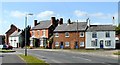
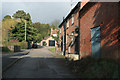
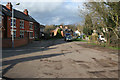
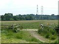
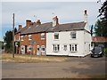
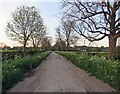
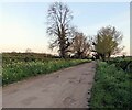
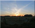
41 photos from this area
Area Information
Key information about the LE12 5NH including its size, population, and administrative classification.
- Area Type
- Postcode
- Area Size
- 1.4 km²
- Population
- 2786
- Population Density
- 148 people/km²
House Prices in LE12 5NH
50
Properties
£417,797
Average Sold Price
£265,000
Lowest Price
£845,000
Highest Price
Showing 50 properties
| Address | Type | Beds | Baths | Last Sale Price | Last Sale Date | |
|---|---|---|---|---|---|---|
| 50 Park Lane, Sutton Bonington, LE12 5NH | house | 5 | 4 | £845,000 | Aug 2025 | |
| 12 Park Lane, Sutton Bonington, LE12 5NH | Detached | 4 | 2 | £425,000 | Mar 2025 | |
| 62 Park Lane, Sutton Bonington, LE12 5NH | Bungalow | 3 | 1 | £400,000 | Jul 2022 | |
| 30 Park Lane, Sutton Bonington, LE12 5NH | house | - | - | £510,000 | Sep 2021 | |
| 26 Park Lane, Sutton Bonington, LE12 5NH | house | - | - | £500,000 | Jun 2021 | |
| 68 Park Lane, Sutton Bonington, LE12 5NH | Bungalow | - | - | £408,000 | Oct 2020 | |
| 18 Park Lane, Sutton Bonington, LE12 5NH | house | - | - | £490,000 | Apr 2019 | |
| 46 Park Lane, Sutton Bonington, LE12 5NH | Detached | 4 | 1 | £425,000 | Nov 2018 | |
| 38 Park Lane, Sutton Bonington, LE12 5NH | Detached | 4 | 2 | £480,000 | Aug 2018 | |
| 54 Park Lane, Sutton Bonington, LE12 5NH | Semi-detached | - | - | £400,000 | Sep 2017 |
Page 1 of 5
Energy Efficiency in LE12 5NH
Amenities
Schools
| Rank | School | Type | Entry gender | Ages |
|---|
Explore more schools in this area
Go to Schools tabDemographics
Household Size
Two person
most common
Accommodation Type
Houses
most common
Tenure
77
majority
Ethnic Group
White
most common
Religion
N/A
most common
Household Composition
N/A
most common
Age
47
median
Young Adults (15-29 years)
most common
Household Deprivation
N/A
with no deprivation
NS-SEC
32
in Lower managerial occupations
Explore more demographic insights in this area
Go to Demographics tabPlanning
Planning Constraints
- Flood RiskPremium
- Ramsar Wetland SitesPremium
- Area of Outstanding Natural BeautyPremium
- Protected Nature ReservePremium
- Protected WoodlandPremium