Area Overview for LE12 5AS
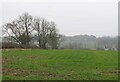
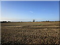
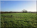
Photos of LE12 5AS


Area Information
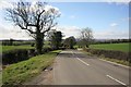
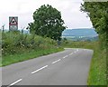
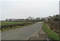
Living in LE12 5AS offers a quiet, residential lifestyle in a small cluster of homes spread across England. With a population of 1,358 and a density of 64 people per square kilometre, the area feels intimate, with a focus on local living. The median age of 47 suggests a community of established residents, many of whom are in the 30-64 age range. This is a place where homeownership is strong — 86% of properties are owner-occupied — and the housing stock is predominantly houses rather than flats. The area’s low flood risk and below-average crime rate, scoring 83 out of 100 for safety, make it appealing for families seeking stability. Proximity to nearby towns like Loughborough and Barrow upon Soar provides access to services without the need for long commutes. While the area is small, its blend of safety, affordability, and connectivity to regional hubs makes it a practical choice for those prioritising a balanced, low-stress lifestyle.
- Area Type
- Postcode
- Area Size
- Not available
- Population
- 1358
- Population Density
- 64 people/km²
The property market in LE12 5AS is characterised by a high rate of homeownership, with 86% of properties owned by their occupants. This indicates a stable, long-term resident base rather than a transient rental market. The area’s housing stock is predominantly houses, which are more common than flats or apartments. Given the small size of the postcode area, the number of available properties is limited, making it a niche market for buyers seeking a quiet, low-density environment. The focus on owner-occupied homes suggests that the area may appeal to those prioritising security and investment over rental yields. For buyers, the compact nature of the area means proximity to nearby towns like Loughborough and Barrow upon Soar is key, offering access to larger amenities while maintaining a sense of local community.
House Prices in LE12 5AS
No properties found in this postcode.
Energy Efficiency in LE12 5AS
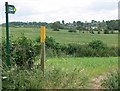
The lifestyle in LE12 5AS is shaped by its proximity to essential amenities, including five retail outlets such as Co-op Barrow, Spar, and Co-op Quorn. These shops provide convenience for daily needs, from groceries to essentials. The area’s transport links to nearby rail and metro stations — including Loughborough Central and Sileby — enable easy access to larger towns for dining, leisure, and cultural activities. While the immediate area lacks large parks or recreational spaces, the surrounding towns offer more extensive options. The combination of local retail, reliable transport, and a low-stress environment creates a practical, community-focused lifestyle. Residents can enjoy the benefits of small-town living while retaining access to regional services, making it ideal for those valuing convenience without sacrificing a sense of place.
Amenities
Schools
The nearest school to LE12 5AS is Burton-on-the-Wolds Primary School, which has an outstanding Ofsted rating. This school serves the local community with primary education, providing a strong foundation for young families. The absence of secondary schools in the immediate area means residents may need to consider commuting to nearby towns for higher education. However, the presence of a high-performing primary school is a significant advantage for families, offering a reliable and quality educational option close to home. The school’s rating suggests it meets or exceeds national standards, which can be a deciding factor for parents prioritising academic outcomes. While the data does not list additional schools, the focus on primary education highlights the area’s suitability for families with young children.
| Rank | School | Type | Entry gender | Ages |
|---|
Explore more schools in this area
Go to Schools tabDemographics
The community in LE12 5AS is largely composed of adults aged 30-64, with a median age of 47. This suggests a population that is largely settled, with fewer young families or elderly residents compared to other areas. Homeownership is high — 86% of residents own their homes — which aligns with the predominance of houses as the primary accommodation type. The area’s predominant ethnic group is White, reflecting a relatively homogenous demographic profile. While the data does not specify deprivation levels, the high homeownership rate and low crime score imply a stable, middle-income community. The absence of detailed diversity metrics means the area’s cultural composition remains less defined, but the focus on family-oriented living and safety suggests a cohesive, long-term resident base.
Household Size
Accommodation Type
Tenure
Ethnic Group
Religion
Household Composition
Age
Household Deprivation
NS-SEC
Explore more demographic insights in this area
Go to Demographics tabPlanning
Planning Constraints
- Flood RiskPremium
- Ramsar Wetland SitesPremium
- Area of Outstanding Natural BeautyPremium
- Protected Nature ReservePremium
- Protected WoodlandPremium