Area Overview for LE11 5TJ
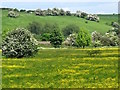
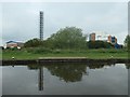
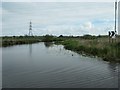
Photos of LE11 5TJ
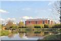

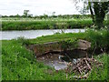

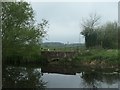
![Flying the Yorkshire flag at Bishop Meadow lock [no 54] in LE11 5TJ](https://images.propbar.co.uk/images/geograph/61/81/6181861_120.jpg)
Area Information
Living in LE11 5TJ offers a compact, residential experience shaped by its small cluster of homes and proximity to essential services. With a population of 1,669 people spread across 682 residents per square kilometre, this area balances intimacy with practicality. The community is predominantly composed of adults aged 30–64, reflecting a mature, stable demographic. Daily life here is anchored by local amenities, including retail outlets like Aldi Derby and Lidl Derby, and easy access to rail networks such as Loughborough Railway Station. The area’s proximity to East Midlands Airport and multiple metro stops enhances its connectivity, making it suitable for commuters or those reliant on transport links. While the housing stock is primarily composed of houses, the relatively low population density suggests a quiet, low-rise character. For buyers, LE11 5TJ represents a blend of convenience and tranquillity, with minimal environmental constraints and a straightforward, unpretentious lifestyle.
- Area Type
- Postcode
- Area Size
- Not available
- Population
- 1669
- Population Density
- 682 people/km²
The property market in LE11 5TJ is characterised by a 50% home ownership rate, suggesting a balance between owner-occupied and rental properties. The accommodation type is exclusively houses, which is unusual for areas with higher population densities but fits LE11 5TJ’s low-rise, residential profile. This composition indicates a market skewed towards family homes rather than apartments or flats. Given the small size of the area, the housing stock is likely limited, which could influence availability and competition for buyers. The predominance of houses may appeal to those seeking space and privacy, though the compact nature of the postcode means proximity to amenities is a key selling point. Buyers should consider the area’s immediate surroundings for additional housing options, as the cluster itself is small.
House Prices in LE11 5TJ
No properties found in this postcode.
Energy Efficiency in LE11 5TJ
Residents of LE11 5TJ have access to a range of nearby amenities that support daily life. The retail sector includes supermarkets like Aldi Derby, Lidl Derby, and Co-op Knighthorpe, ensuring convenience for grocery shopping. Rail and metro stations, such as Loughborough Central and Rothley, provide easy access to commuting routes and regional hubs. The proximity to East Midlands Airport, listed twice in the data, highlights the area’s role in travel and logistics. While the data does not specify parks or leisure facilities, the absence of environmental constraints like protected woodlands or AONB designations suggests open space may be available locally. The combination of retail, transport, and travel options creates a practical, functional lifestyle, ideal for those prioritising accessibility over sprawling green spaces.
Amenities
Schools
| Rank | School | Type | Entry gender | Ages |
|---|
Explore more schools in this area
Go to Schools tabDemographics
The community in LE11 5TJ is defined by its median age of 47, with the majority of residents falling within the 30–64 age range. This suggests a population skewed towards established families and professionals, rather than younger or elderly demographics. Home ownership stands at 50%, indicating a balanced mix of owner-occupied properties and rental homes. The accommodation type is predominantly houses, which aligns with the area’s low-rise, residential character. The predominant ethnic group is White, reflecting a homogenous demographic profile. While no specific data on deprivation is provided, the age and ownership statistics imply a stable, middle-income community with moderate demands on local services. The absence of significant diversity metrics means the area’s social fabric is largely shaped by its core demographic group.
Household Size
Accommodation Type
Tenure
Ethnic Group
Religion
Household Composition
Age
Household Deprivation
NS-SEC
Explore more demographic insights in this area
Go to Demographics tabPlanning
Planning Constraints
- Flood RiskPremium
- Ramsar Wetland SitesPremium
- Area of Outstanding Natural BeautyPremium
- Protected Nature ReservePremium
- Protected WoodlandPremium