Area Overview for LE11 5HU
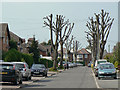
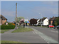
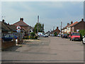
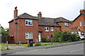
Photos of LE11 5HU
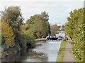
![Grand Union Canal below Loughborough Lock [no 53] in LE11 5HU](https://images.propbar.co.uk/images/geograph/61/78/6178441_120.jpg)
49 photos from this area
Area Information
Key information about the LE11 5HU including its size, population, and administrative classification.
- Area Type
- Postcode
- Area Size
- 2.3 hectares
- Population
- 1669
- Population Density
- 682 people/km²
House Prices in LE11 5HU
33
Properties
£161,328
Average Sold Price
£43,250
Lowest Price
£310,000
Highest Price
Showing 33 properties
| Address | Type | Beds | Baths | Last Sale Price | Last Sale Date | |
|---|---|---|---|---|---|---|
| 37 Kings Avenue, Loughborough, LE11 5HU | Bungalow | 4 | 2 | £310,000 | Mar 2025 | |
| 7 Kings Avenue, Loughborough, LE11 5HU | Semi-detached | 3 | 1 | £195,000 | Aug 2023 | |
| 53 Kings Avenue, Loughborough, LE11 5HU | Semi-detached | 3 | 1 | £240,000 | Jan 2023 | |
| 25 Kings Avenue, Loughborough, LE11 5HU | house | 3 | 1 | £199,950 | Feb 2021 | |
| 29 Kings Avenue, Loughborough, LE11 5HU | house | - | - | £161,000 | Mar 2020 | |
| 59 Kings Avenue, Loughborough, LE11 5HU | Semi-detached | 3 | 1 | £218,000 | Mar 2019 | |
| 19 Kings Avenue, Loughborough, LE11 5HU | Semi-detached | 3 | - | £203,000 | Nov 2018 | |
| 31 Kings Avenue, Loughborough, LE11 5HU | Semi-detached | 3 | 1 | £182,000 | Oct 2018 | |
| 35A Kings Avenue, Loughborough, LE11 5HU | Retail | 3 | 2 | £160,000 | Dec 2017 | |
| 21 Kings Avenue, Loughborough, LE11 5HU | Semi-detached | 3 | 1 | £150,000 | May 2016 |
Page 1 of 4
Energy Efficiency in LE11 5HU
Amenities
Schools
| Rank | School | Type | Entry gender | Ages |
|---|
Explore more schools in this area
Go to Schools tabDemographics
Household Size
One person
most common
Accommodation Type
Houses
most common
Tenure
50
majority
Ethnic Group
White
most common
Religion
N/A
most common
Household Composition
N/A
most common
Age
47
median
Adults (30-64 years)
most common
Household Deprivation
N/A
with no deprivation
NS-SEC
19
in Lower managerial occupations
Explore more demographic insights in this area
Go to Demographics tabPlanning
Planning Constraints
- Flood RiskPremium
- Ramsar Wetland SitesPremium
- Area of Outstanding Natural BeautyPremium
- Protected Nature ReservePremium
- Protected WoodlandPremium