Area Overview for LE11 4PY
Photos of LE11 4PY
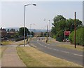
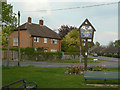
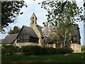
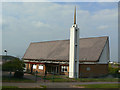
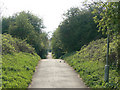
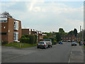
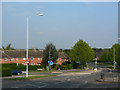
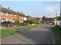
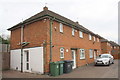
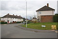
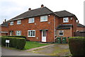

45 photos from this area
Area Information
Key information about the LE11 4PY including its size, population, and administrative classification.
- Area Type
- Postcode
- Area Size
- 1.9 hectares
- Population
- 3089
- Population Density
- 4628 people/km²
House Prices in LE11 4PY
52
Properties
£118,157
Average Sold Price
£16,000
Lowest Price
£244,000
Highest Price
Showing 52 properties
| Address | Type | Beds | Baths | Last Sale Price | Last Sale Date | |
|---|---|---|---|---|---|---|
| 67 Blackbrook Road, Loughborough, LE11 4PY | Semi-detached | 3 | 1 | £244,000 | May 2025 | |
| 97 Blackbrook Road, Loughborough, LE11 4PY | house | 3 | 1 | £167,500 | Feb 2022 | |
| 37 Blackbrook Road, Loughborough, LE11 4PY | house | - | - | £172,000 | Mar 2021 | |
| 23 Blackbrook Road, Loughborough, LE11 4PY | house | - | - | £165,000 | Oct 2020 | |
| 41 Blackbrook Road, Loughborough, LE11 4PY | house | - | - | £140,000 | Jun 2019 | |
| 33 Blackbrook Road, Loughborough, LE11 4PY | Semi-detached | - | - | £125,000 | Jul 2015 | |
| 55 Blackbrook Road, Loughborough, LE11 4PY | Terraced | 3 | - | £122,000 | Jul 2015 | |
| 21 Blackbrook Road, Loughborough, LE11 4PY | house | 3 | - | £148,000 | Jun 2015 | |
| 73 Blackbrook Road, Loughborough, LE11 4PY | house | - | - | £121,500 | Sep 2013 | |
| 63 Blackbrook Road, Loughborough, LE11 4PY | house | 3 | - | £116,000 | Jul 2013 |
Page 1 of 6
Energy Efficiency in LE11 4PY
Amenities
Schools
| Rank | School | Type | Entry gender | Ages |
|---|
Explore more schools in this area
Go to Schools tabDemographics
Household Size
Family (3-5 people)
most common
Accommodation Type
Houses
most common
Tenure
41
majority
Ethnic Group
White
most common
Religion
N/A
most common
Household Composition
N/A
most common
Age
22
median
Young Adults (15-29 years)
most common
Household Deprivation
N/A
with no deprivation
NS-SEC
10
in Lower managerial occupations
Explore more demographic insights in this area
Go to Demographics tabPlanning
Planning Constraints
- Flood RiskPremium
- Ramsar Wetland SitesPremium
- Area of Outstanding Natural BeautyPremium
- Protected Nature ReservePremium
- Protected WoodlandPremium