Area Overview for LE11 4FT
Photos of LE11 4FT
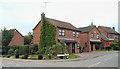
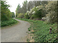
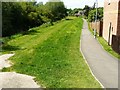
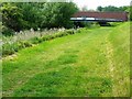
36 photos from this area
Area Information
Key information about the LE11 4FT including its size, population, and administrative classification.
- Area Type
- Postcode
- Area Size
- 25.4 hectares
- Population
- 1304
- Population Density
- 1265 people/km²
House Prices in LE11 4FT
13
Properties
£262,154
Average Sold Price
£109,950
Lowest Price
£415,000
Highest Price
Showing 13 properties
| Address | Type | Beds | Baths | Last Sale Price | Last Sale Date | |
|---|---|---|---|---|---|---|
| 4 Kingswood Avenue, Loughborough, LE11 4FT | Bungalow | 2 | 1 | £310,000 | Dec 2025 | |
| 5 Kingswood Avenue, Loughborough, LE11 4FT | house | - | - | £415,000 | Dec 2025 | |
| 15 Kingswood Avenue, Loughborough, LE11 4FT | Bungalow | 3 | 2 | £385,000 | Oct 2023 | |
| 12 Kingswood Avenue, Loughborough, LE11 4FT | house | 4 | 2 | £370,000 | Sep 2023 | |
| 7 Kingswood Avenue, Loughborough, LE11 4FT | house | - | - | £305,000 | Jul 2015 | |
| 11 Kingswood Avenue, Loughborough, LE11 4FT | house | - | - | £280,000 | Sep 2014 | |
| 1 Kingswood Avenue, Loughborough, LE11 4FT | house | - | - | £275,000 | Dec 2010 | |
| 9 Kingswood Avenue, Loughborough, LE11 4FT | Detached | 5 | 2 | £249,995 | Nov 2006 | |
| 2 Kingswood Avenue, Loughborough, LE11 4FT | Detached | - | - | £187,000 | Mar 2005 | |
| 10 Kingswood Avenue, Loughborough, LE11 4FT | Detached | - | - | £109,950 | Feb 1999 |
Page 1 of 2
Energy Efficiency in LE11 4FT
Amenities
Schools
| Rank | School | Type | Entry gender | Ages |
|---|
Explore more schools in this area
Go to Schools tabDemographics
Household Size
Two person
most common
Accommodation Type
Houses
most common
Tenure
88
majority
Ethnic Group
White
most common
Religion
N/A
most common
Household Composition
N/A
most common
Age
47
median
Adults (30-64 years)
most common
Household Deprivation
N/A
with no deprivation
NS-SEC
33
in Lower managerial occupations
Explore more demographic insights in this area
Go to Demographics tabPlanning
Planning Constraints
- Flood RiskPremium
- Ramsar Wetland SitesPremium
- Area of Outstanding Natural BeautyPremium
- Protected Nature ReservePremium
- Protected WoodlandPremium