Area Overview for LE11 3UF
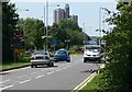
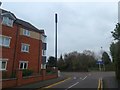
Photos of LE11 3UF


Area Information
Living in LE11 3UF offers a compact, residential experience shaped by its proximity to Loughborough University and its small, tightly knit community. With a population of 2,292, this area is characterised by a youthful demographic, with the median age at 22 and most residents falling within the 15–29 age bracket. The area’s proximity to the university suggests a mix of students and young professionals, creating a dynamic, student-influenced environment. Daily life is defined by easy access to local amenities, including retail outlets like Tesco Loughborough and Spar, as well as transport links such as Loughborough Railway Station. The low crime risk score of 84 and no flood or environmental hazards contribute to a sense of security. While the area is small, its connectivity to nearby towns and the East Midlands Airport ensures practicality for commuting and travel. This postcode is ideal for those seeking a quiet, community-focused lifestyle with strong infrastructure and minimal environmental risks.
- Area Type
- Postcode
- Area Size
- Not available
- Population
- 2292
- Population Density
- 3586 people/km²
The property market in LE11 3UF is dominated by owner-occupied homes, with 81% of residents living in properties they own. Houses are the primary accommodation type, indicating a focus on single-family dwellings rather than apartments or flats. This suggests a market tailored to families or individuals seeking long-term stability, though the small area size means housing options are limited. The high home ownership rate implies a lower rental market, which could be a challenge for those seeking short-term accommodation. Buyers in this area may find a tight market with fewer properties available, but the emphasis on houses offers a sense of space and permanence. Proximity to Loughborough University may also influence property values, with demand potentially driven by students and young professionals.
House Prices in LE11 3UF
No properties found in this postcode.
Energy Efficiency in LE11 3UF
Residents of LE11 3UF have access to a range of amenities within practical reach. Local retail options include Co-op UNIF, Tesco Loughborough, and Spar, ensuring everyday shopping needs are met. The area’s transport network, with rail and metro stations, connects it to broader regional hubs. The proximity to the East Midlands Airport adds convenience for travel. While the data does not specify parks or leisure facilities, the absence of environmental constraints like protected woodlands or AONB designations suggests open spaces may be available nearby. The combination of retail, transport, and travel options creates a lifestyle that balances convenience with the potential for nearby natural or recreational areas. This makes the area appealing to those prioritising accessibility and practicality.
Amenities
Schools
The nearest notable educational institution to LE11 3UF is Loughborough University, though it is categorised as an “other” type rather than a school. No primary or secondary schools are listed in the data, which means families may need to look beyond the immediate area for local schools. The absence of named schools in the dataset suggests that parents should investigate nearby towns or districts for educational options. For those prioritising proximity to higher education, the university’s presence could be a significant draw, but it does not replace the need for K–12 schooling. This highlights the importance of researching surrounding areas to ensure access to a full range of educational facilities.
| Rank | School | Type | Entry gender | Ages |
|---|
Explore more schools in this area
Go to Schools tabDemographics
The community in LE11 3UF is overwhelmingly young, with 81% of the population aged 15–29. This reflects the influence of nearby Loughborough University, which likely contributes to the area’s student population. The high home ownership rate of 81% suggests a stable, long-term resident base, with houses being the predominant accommodation type. The predominant ethnic group is White, and no specific data on diversity or deprivation is provided, though the low crime risk score of 84 indicates a generally safe environment. The young age profile and high home ownership suggest a community focused on education and early career development. With a population of 2,292, the area is small but cohesive, offering a distinct local identity shaped by its proximity to higher education and limited external influences.
Household Size
Accommodation Type
Tenure
Ethnic Group
Religion
Household Composition
Age
Household Deprivation
NS-SEC
Explore more demographic insights in this area
Go to Demographics tabPlanning
Planning Constraints
- Flood RiskPremium
- Ramsar Wetland SitesPremium
- Area of Outstanding Natural BeautyPremium
- Protected Nature ReservePremium
- Protected WoodlandPremium