Area Overview for LE11 3TD
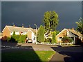
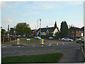
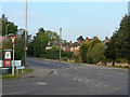
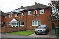
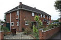
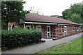
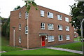
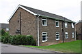
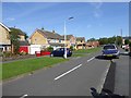
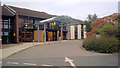
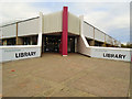
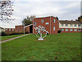
Photos of LE11 3TD
Area Information
LE11 3TD is a small residential postcode area in England, covering just 2.7 hectares and home to 1,645 residents. Its high population density of 60,776 people per square kilometre reflects its compact nature, typical of a tightly knit neighbourhood. This area is characterised by a focus on housing, with 75% of residents owning their homes. The median age of 47 suggests a mature community, with the majority of residents falling within the 30–64 age range. Daily life here is shaped by proximity to essential services and transport links, making it practical for those who value convenience. While the area is small, it is well-connected to nearby towns and cities, offering a balance between residential tranquillity and accessibility. The absence of significant environmental constraints, such as protected woodlands or wetlands, means development and living here is straightforward. For buyers seeking a compact, owner-occupied area with established infrastructure, LE11 3TD presents a focused option.
- Area Type
- Postcode
- Area Size
- 2.7 hectares
- Population
- 1645
- Population Density
- 4256 people/km²
The property market in LE11 3TD is dominated by owner-occupied homes, with 75% of residents owning their properties. The area is composed primarily of houses rather than flats, which may appeal to buyers seeking larger, more private living spaces. Given the small size of the postcode area, the housing stock is limited, meaning properties here are likely to be in high demand relative to supply. This could drive competitive pricing, particularly for well-maintained homes. The absence of rental market data suggests that the area is not a major hub for tenants, though proximity to transport links like Loughborough Central station may attract commuters. Buyers should consider the compact nature of the area, as expansion is unlikely. For those prioritising ownership and a traditional housing format, LE11 3TD offers a focused opportunity.
House Prices in LE11 3TD
Showing 1 properties
| Address | Type | Beds | Baths | Last Sale Price | Last Sale Date | |
|---|---|---|---|---|---|---|
| Burleigh Court Hotel And Conference Centre, University Road, University Campus, Loughborough, LE11 3TD | hotel | - | - | - | - |
Energy Efficiency in LE11 3TD
Living in LE11 3TD offers access to a range of amenities within practical reach. Nearby retail options include Spar, Co-op UNIF, and Co-op Knighthorpe, providing essential shopping for daily needs. The area’s proximity to Loughborough Central station and other rail links ensures convenient travel to larger towns for more extensive retail and dining experiences. While no specific parks or leisure facilities are listed, the absence of protected natural areas suggests open spaces may be limited. However, the density of transport options and retail hubs indicates a lifestyle focused on accessibility and convenience. Residents can easily access regional airports and connect to broader networks, enhancing both practicality and opportunities for leisure and travel.
Amenities
Schools
The nearest school to LE11 3TD is Ashmount School, a special school catering to students with specific educational needs. No Ofsted rating is provided, but the presence of a special school indicates the area may serve families with children requiring tailored support. However, the absence of mainstream schools like primary or secondary institutions suggests that residents may need to look further afield for general education. This could be a consideration for families planning long-term stays or those requiring a full range of schooling options. While the data does not include other schools, the proximity to Loughborough and nearby towns may provide access to broader educational networks.
| Rank | School | Type | Entry gender | Ages |
|---|
Explore more schools in this area
Go to Schools tabDemographics
The population of LE11 3TD is predominantly adults aged 30–64, with a median age of 47. This suggests a community of middle-aged residents, many of whom are likely to be established professionals or families. Home ownership is high at 75%, indicating a stable, long-term resident base. The area is composed mainly of houses, which aligns with the demographic profile of older, family-oriented households. The predominant ethnic group is White, reflecting broader regional trends. While no specific data on deprivation is provided, the high home ownership rate and low crime risk suggest a relatively affluent and secure environment. The absence of significant diversity data means the community is likely homogenous, though this does not necessarily imply a lack of inclusivity. For buyers, the age profile and housing stock suggest a neighbourhood suited to those seeking stability and proximity to services.
Household Size
Accommodation Type
Tenure
Ethnic Group
Religion
Household Composition
Age
Household Deprivation
NS-SEC
Explore more demographic insights in this area
Go to Demographics tabPlanning
Planning Constraints
- Flood RiskPremium
- Ramsar Wetland SitesPremium
- Area of Outstanding Natural BeautyPremium
- Protected Nature ReservePremium
- Protected WoodlandPremium