Area Overview for LE11 2XF
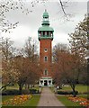
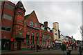
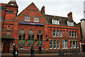
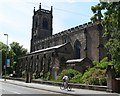
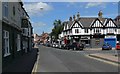
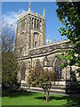
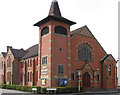
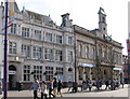
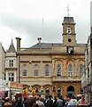
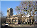
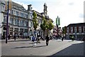
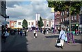
Photos of LE11 2XF
Area Information
Living in LE11 2XF means inhabiting a compact, densely populated residential cluster in England. The area covers just 1.0 hectare, housing 1,459 people in a space that translates to 140,668 people per square kilometre. This small postcode is defined by its high population density and a demographic skewed toward young adults, with a median age of 22. The community is predominantly renters, with only 31% of homes owned outright, and the accommodation is largely flats. Daily life here is shaped by proximity to nearby towns like Loughborough, where amenities, schools, and transport links are accessible. The area’s small footprint means residents are likely to rely on nearby towns for broader services, though the immediate vicinity offers a tightly knit, youthful environment. For those seeking a compact, convenient living space with a focus on proximity to urban hubs, LE11 2XF presents a distinct proposition, albeit with a high population density that may influence the character of the neighbourhood.
- Area Type
- Postcode
- Area Size
- 1.0 hectares
- Population
- 1459
- Population Density
- 2925 people/km²
The property market in LE11 2XF is characterised by a high proportion of rental properties, with only 31% of homes owned by residents. The accommodation type is exclusively flats, which aligns with the area’s small size and high population density. This suggests that the housing stock is primarily suited to short-term or transient occupants, such as students or young professionals, rather than long-term owner-occupiers. Buyers seeking owner-occupied properties in this small postcode will find limited options, with the majority of the market catering to renters. The immediate surroundings may offer more varied housing, but within LE11 2XF itself, the focus is on flats. This dynamic means that property buyers should consider the area’s suitability for investment or long-term residency based on its rental-centric nature and spatial constraints.
House Prices in LE11 2XF
Showing 1 properties
| Address | Type | Beds | Baths | Last Sale Price | Last Sale Date | |
|---|---|---|---|---|---|---|
| Cbc Southfields Park Goal Posts, Cbc Southfields Park, Leicester Road, Loughborough, LE11 2XF | Leisure | - | - | - | - |
Energy Efficiency in LE11 2XF
Residents of LE11 2XF benefit from nearby amenities that cater to daily needs. Retail options include Tesco Leicester, Iceland Loughborough, and Spar, offering groceries and convenience goods. Metro stations like Loughborough Central and Quorn & Woodhouse provide easy access to public transport, while rail stations such as Loughborough and Sileby connect to regional networks. Though the area itself is compact, its proximity to larger towns ensures a range of leisure and dining options. The high population density may mean limited parks or open spaces, but the presence of multiple transport hubs and retail centres suggests a lifestyle focused on convenience and connectivity. The mix of retail, transport, and nearby schools indicates a practical, urban-oriented living environment tailored to those prioritising accessibility over expansive green spaces.
Amenities
Schools
Residents of LE11 2XF have access to several independent schools within practical reach. These include Loughborough Amherst School, Loughborough Grammar School, Loughborough High School, Fairfield Prep School, and Ellerslie School. All listed institutions are independent, offering fee-paying education. The concentration of independent schools suggests a strong emphasis on private education in the area, though the data does not specify Ofsted ratings or academic performance. Families seeking independent schooling will find multiple options nearby, but the absence of state schools or mixed-sector data means the educational landscape is entirely private. This could influence decisions for those prioritising affordability or diversity in schooling options.
| Rank | School | Type | Entry gender | Ages |
|---|
Explore more schools in this area
Go to Schools tabDemographics
The community in LE11 2XF is overwhelmingly young, with a median age of 22 and the majority of residents falling within the 15–29 age range. Home ownership is low, at just 31%, indicating a rental-dominated market. The accommodation type is predominantly flats, reflecting the area’s compact size and high density. The predominant ethnic group is White, though no specific diversity statistics are provided. The population density of 140,668 people per square kilometre is exceptionally high, comparable to urban centres, which may influence the social dynamics and availability of private space. For quality of life, this density could mean limited green spaces or communal areas, but it also fosters a tightly connected community. The demographic profile suggests a transient or student-oriented population, given the age range and rental focus, though this is not explicitly confirmed by the data.
Household Size
Accommodation Type
Tenure
Ethnic Group
Religion
Household Composition
Age
Household Deprivation
NS-SEC
Explore more demographic insights in this area
Go to Demographics tabPlanning
Planning Constraints
- Flood RiskPremium
- Ramsar Wetland SitesPremium
- Area of Outstanding Natural BeautyPremium
- Protected Nature ReservePremium
- Protected WoodlandPremium