Area Overview for LE11 2QB
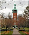
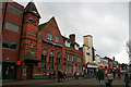
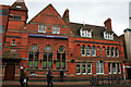
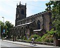
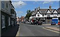
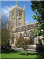
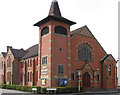
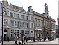
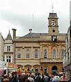
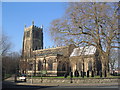
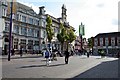
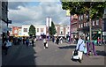
Photos of LE11 2QB
Area Information
Living in LE11 2QB means inhabiting a compact, densely populated residential cluster in England. The area covers just 904 square metres, yet it accommodates 1,507 residents, translating to a population density of 1.67 million people per square kilometre. This small postcode is characterised by its focus on flats, reflecting a community shaped by shared living spaces. Daily life here is defined by proximity to essential services, with nearby retail hubs like M&S Loughborough and Tesco Leicester within practical reach. The area’s compact nature means residents are close to transport links, including Loughborough Railway Station and multiple metro stops. While the demographic data suggests a mature population, with a median age of 47 and most residents aged 30–64, the area’s high population density and flat-dominated housing stock indicate a mix of long-term residents and those seeking affordable, convenient living. LE11 2QB is not a sprawling suburb but a tightly woven community, where the rhythm of life is set by proximity to amenities and the pace of urban connectivity.
- Area Type
- Postcode
- Area Size
- 904 m²
- Population
- 1507
- Population Density
- 6985 people/km²
The property market in LE11 2QB is dominated by flats, with 19% of residents owning their homes. This low home ownership rate suggests the area is more rental-focused than owner-occupied, which could influence the types of properties available. Flats are the primary accommodation, likely in multi-unit buildings, reflecting a need for space-efficient housing in a densely packed postcode. For buyers, this means limited opportunities to purchase owner-occupied homes, with most properties likely being rented out by landlords. The small area size of 904 m² and high population density indicate that the housing stock is tightly concentrated, potentially leading to competition for available properties. Nearby areas may offer more varied options, but within LE11 2QB itself, the market is constrained by the small footprint. Prospective buyers should consider the rental market dynamics and whether the flat-based housing suits their long-term needs, particularly if they prioritise private outdoor space or larger homes.
House Prices in LE11 2QB
No properties found in this postcode.
Energy Efficiency in LE11 2QB
Residents of LE11 2QB enjoy a mix of retail, transport, and leisure options within easy reach. The area’s retail offerings include M&S Loughborough, Iceland Loughborough, and Tesco Leicester, providing access to shopping, groceries, and everyday essentials. For transport, three metro stops and three rail stations offer connections to Loughborough and surrounding areas, facilitating both commuting and weekend travel. The presence of nearby amenities like Loughborough Central metro station and Sileby Railway Station ensures residents can navigate the region efficiently. While the area itself is compact, the surrounding infrastructure suggests a lifestyle that balances urban convenience with access to broader networks. The combination of retail, transport, and proximity to services like Cobden Primary School creates a functional environment for daily life. However, the lack of detailed data on parks or leisure facilities means the area’s recreational offerings remain unspecified, though the high population density implies limited private outdoor space for residents.
Amenities
Schools
Residents of LE11 2QB have access to Cobden Primary School & Community Centre, a primary school with an Ofsted rating of satisfactory, and Trinity College, a special school. The presence of both primary and special education institutions suggests a range of needs is catered to, from early years education to specialist support for students with specific requirements. For families with young children, Cobden Primary offers a local option, though its rating indicates there may be room for improvement in areas like teaching quality or student outcomes. Trinity College’s role as a special school highlights the area’s commitment to inclusive education, though it may not be suitable for all households. The combination of school types means parents have options but should assess whether the specific needs of their children align with the available provision. The proximity of these schools to the area’s high-density housing suggests a focus on accessibility, though the lack of secondary schools nearby may require families to look further afield.
| Rank | School | Type | Entry gender | Ages |
|---|
Explore more schools in this area
Go to Schools tabDemographics
The community in LE11 2QB is predominantly composed of adults aged 30–64, with a median age of 47. This suggests a mature, stable population, likely with established careers and family ties. Home ownership is low at 19%, indicating that most residents are either renters or live in shared accommodations. The accommodation type is primarily flats, reflecting a housing stock suited to urban living rather than detached homes. The predominant ethnic group is White, though no specific data on diversity or deprivation levels is provided. The high population density—1.67 million people per square kilometre—suggests a compact, possibly multi-generational living environment. For residents, this density may mean limited private outdoor space but strong community ties. The age profile implies a workforce-centric area, with potential for local employment opportunities, though the data does not specify employment rates or industries. The lack of protected natural areas or wetlands in the area also suggests a focus on urban infrastructure over rural tranquillity.
Household Size
Accommodation Type
Tenure
Ethnic Group
Religion
Household Composition
Age
Household Deprivation
NS-SEC
Explore more demographic insights in this area
Go to Demographics tabPlanning
Planning Constraints
- Flood RiskPremium
- Ramsar Wetland SitesPremium
- Area of Outstanding Natural BeautyPremium
- Protected Nature ReservePremium
- Protected WoodlandPremium