Area Overview for LE11 2JS
Photos of LE11 2JS

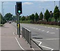
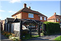
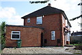
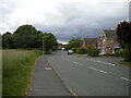
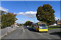
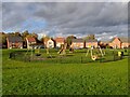
23 photos from this area
Area Information
Key information about the LE11 2JS including its size, population, and administrative classification.
- Area Type
- Postcode
- Area Size
- 8.0 hectares
- Population
- 1717
- Population Density
- 4703 people/km²
House Prices in LE11 2JS
51
Properties
£132,574
Average Sold Price
£36,000
Lowest Price
£230,000
Highest Price
Showing 51 properties
| Address | Type | Beds | Baths | Last Sale Price | Last Sale Date | |
|---|---|---|---|---|---|---|
| 41 Poplar Road, Loughborough, LE11 2JS | Detached | 3 | 1 | £230,000 | Jul 2025 | |
| 15 Poplar Road, Loughborough, LE11 2JS | Terraced | 3 | 1 | £155,000 | Mar 2025 | |
| 21 Poplar Road, Loughborough, LE11 2JS | Semi-detached | 3 | 1 | £230,000 | Aug 2024 | |
| 49 Poplar Road, Loughborough, LE11 2JS | house | - | - | £172,259 | Aug 2022 | |
| 95 Poplar Road, Loughborough, LE11 2JS | Terraced | - | - | £190,000 | Jan 2022 | |
| 39 Poplar Road, Loughborough, LE11 2JS | house | 3 | 1 | £187,000 | Aug 2021 | |
| 99 Poplar Road, Loughborough, LE11 2JS | Semi-detached | 3 | 1 | £178,000 | Oct 2020 | |
| 101 Poplar Road, Loughborough, LE11 2JS | Detached | 3 | 1 | £90,000 | May 2020 | |
| 57 Poplar Road, Loughborough, LE11 2JS | Semi-detached | 3 | 1 | £165,000 | Nov 2019 | |
| 77 Poplar Road, Loughborough, LE11 2JS | Terraced | 3 | 1 | £146,000 | Sep 2017 |
Page 1 of 6
Energy Efficiency in LE11 2JS
Amenities
Schools
| Rank | School | Type | Entry gender | Ages |
|---|
Explore more schools in this area
Go to Schools tabDemographics
Household Size
Family (3-5 people)
most common
Accommodation Type
Houses
most common
Tenure
47
majority
Ethnic Group
White
most common
Religion
N/A
most common
Household Composition
N/A
most common
Age
47
median
Adults (30-64 years)
most common
Household Deprivation
N/A
with no deprivation
NS-SEC
17
in Lower managerial occupations
Explore more demographic insights in this area
Go to Demographics tabPlanning
Planning Constraints
- Flood RiskPremium
- Ramsar Wetland SitesPremium
- Area of Outstanding Natural BeautyPremium
- Protected Nature ReservePremium
- Protected WoodlandPremium