Area Overview for LE11 2AB
Photos of LE11 2AB


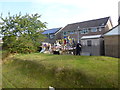

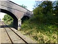
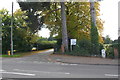
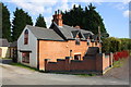
56 photos from this area
Area Information
Key information about the LE11 2AB including its size, population, and administrative classification.
- Area Type
- Postcode
- Area Size
- 8676 m²
- Population
- 1191
- Population Density
- 1964 people/km²
House Prices in LE11 2AB
16
Properties
£228,829
Average Sold Price
£60,000
Lowest Price
£600,000
Highest Price
Showing 16 properties
| Address | Type | Beds | Baths | Last Sale Price | Last Sale Date | |
|---|---|---|---|---|---|---|
| 10 Cedar Road, Loughborough, LE11 2AB | Detached | 3 | 1 | £270,000 | Aug 2025 | |
| 15 Cedar Road, Loughborough, LE11 2AB | Semi-detached | 3 | 1 | £325,000 | Sep 2024 | |
| 14 Cedar Road, Loughborough, LE11 2AB | Retail | 3 | 2 | £300,000 | Apr 2022 | |
| 4 Cedar Road, Loughborough, LE11 2AB | Retail | 3 | 1 | £275,000 | Apr 2022 | |
| 12 Cedar Road, Loughborough, LE11 2AB | house | 4 | 1 | £178,000 | Jun 2020 | |
| 9 Cedar Road, Loughborough, LE11 2AB | house | - | - | £175,000 | Dec 2019 | |
| 1 Cedar Road, Loughborough, LE11 2AB | Semi-detached | 4 | - | £158,000 | May 2017 | |
| 5 Cedar Road, Loughborough, LE11 2AB | Semi-detached | - | - | £160,000 | Jul 2012 | |
| 2 Cedar Road, Loughborough, LE11 2AB | Semi-detached | 3 | 1 | £165,000 | Aug 2010 | |
| Former Managers Accommodation, The Cedars Hotel, Cedar Road, Loughborough, LE11 2AB | Flat | - | - | £600,000 | Sep 2006 |
Page 1 of 2
Energy Efficiency in LE11 2AB
Amenities
Schools
| Rank | School | Type | Entry gender | Ages |
|---|
Explore more schools in this area
Go to Schools tabDemographics
Household Size
Two person
most common
Accommodation Type
Houses
most common
Tenure
81
majority
Ethnic Group
White
most common
Religion
N/A
most common
Household Composition
N/A
most common
Age
47
median
Adults (30-64 years)
most common
Household Deprivation
N/A
with no deprivation
NS-SEC
31
in Lower managerial occupations
Explore more demographic insights in this area
Go to Demographics tabPlanning
Planning Constraints
- Flood RiskPremium
- Ramsar Wetland SitesPremium
- Area of Outstanding Natural BeautyPremium
- Protected Nature ReservePremium
- Protected WoodlandPremium