Area Overview for LE11 1UU
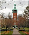
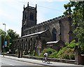
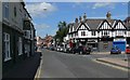
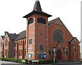
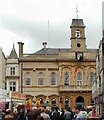
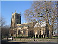
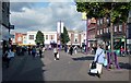
Photos of LE11 1UU


Area Information
Living in LE11 1UU means inhabiting a small, densely populated residential cluster in England. Covering just 676 square metres, this postcode is home to 2,071 people, translating to a population density of over 3 million per square kilometre. The area is defined by its compactness, with a focus on housing that caters to a mature demographic. The median age of 47 suggests a community rooted in middle-aged adults, many of whom are likely to be homeowners or long-term residents. Daily life here is shaped by proximity to essential services and transport links, though the high population density means the area is both lively and tightly packed. Residents benefit from nearby schools, retail hubs, and rail networks, creating a practical, if modest, urban environment. While the area lacks natural amenities like protected woodlands or AONB designations, its strategic location near Loughborough and surrounding towns offers access to broader regional opportunities. For those prioritising convenience over space, LE11 1UU provides a functional base with a clear emphasis on connectivity and accessibility.
- Area Type
- Postcode
- Area Size
- 676 m²
- Population
- 2071
- Population Density
- 6143 people/km²
The property market in LE11 1UU is characterised by a 44% home ownership rate, with houses forming the predominant accommodation type. This suggests a mix of owner-occupied and rental properties, though the exact proportion of the latter is unspecified. Given the area’s small size and high population density, the housing stock is likely to be compact, potentially including terraced or semi-detached homes. The focus on houses rather than flats or apartments may appeal to buyers seeking traditional family homes, though the limited area size could restrict availability. For those considering the market, the 44% home ownership rate indicates that a significant portion of properties are rented, which may influence competition for purchase. The small postcode area means buyers must consider proximity to nearby towns like Loughborough, where larger housing options might be available. The compact nature of LE11 1UU also means that properties here are likely to be in high demand, given the area’s connectivity and access to amenities.
House Prices in LE11 1UU
No properties found in this postcode.
Energy Efficiency in LE11 1UU
The lifestyle in LE11 1UU is shaped by its proximity to retail, transport, and community hubs. Within practical reach are five retail venues, including major chains like M&S Loughborough, Tesco Loughborough, and Sainsburys Loughborough, ensuring that residents have access to everyday shopping needs. The area’s rail and metro networks, including Loughborough Railway Station and Quorn & Woodhouse Metro, provide easy access to nearby towns and cities, enhancing mobility for work, leisure, or social activities. While the data does not mention parks or leisure facilities directly, the absence of planning constraints like AONB or protected woodlands suggests that natural amenities are not a feature of the area. Nonetheless, the compact layout and availability of shops and transport links create a practical, if urban, lifestyle. Residents benefit from a balance of convenience and connectivity, though the high population density may limit opportunities for expansive outdoor spaces or quiet areas.
Amenities
Schools
Residents of LE11 1UU have access to two notable schools within practical reach: Limehurst High School, a primary school, and Limehurst Academy, an academy with a ‘good’ Ofsted rating. The presence of both a primary school and an academy provides a range of educational options for families, from early years to secondary education. Limehurst Academy’s ‘good’ rating indicates a school that meets standards in teaching quality, student outcomes, and management, though it is not the highest possible rating. The proximity of these institutions suggests that the area is well-served for families prioritising education. However, the data does not specify whether these schools are state-funded or independent, nor does it provide additional details on their size or specialisms. For parents, the combination of a primary school and a well-rated academy offers a structured pathway for children’s schooling, though the lack of further data on school performance or capacity may require further investigation.
| Rank | School | Type | Entry gender | Ages |
|---|
Explore more schools in this area
Go to Schools tabDemographics
The community in LE11 1UU is predominantly composed of adults aged 30–64, reflecting a median age of 47. This suggests a population skewed towards middle-aged individuals, many of whom may be in their peak working years. Home ownership stands at 44%, a figure that indicates a mix of owner-occupied and rental properties, though the data does not specify the latter. The accommodation type is primarily houses, which is notable given the small area size and high population density. This implies a compact housing stock, potentially with multi-family homes or terraced properties. The predominant ethnic group is White, though no further breakdown of diversity is provided. The high population density—over 3 million per square kilometre—raises questions about living conditions, though the data does not address overcrowding or deprivation directly. For residents, this density likely fosters a close-knit community but may limit personal space. The age profile and home ownership rate suggest a stable, long-term population with established ties to the area.
Household Size
Accommodation Type
Tenure
Ethnic Group
Religion
Household Composition
Age
Household Deprivation
NS-SEC
Explore more demographic insights in this area
Go to Demographics tabPlanning
Planning Constraints
- Flood RiskPremium
- Ramsar Wetland SitesPremium
- Area of Outstanding Natural BeautyPremium
- Protected Nature ReservePremium
- Protected WoodlandPremium