Area Overview for LE11 1LY
Photos of LE11 1LY
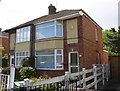
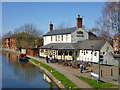
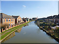
100 photos from this area
Area Information
Key information about the LE11 1LY including its size, population, and administrative classification.
- Area Type
- Postcode
- Area Size
- 7403 m²
- Population
- 1855
- Population Density
- 1366 people/km²
House Prices in LE11 1LY
31
Properties
£98,944
Average Sold Price
£44,500
Lowest Price
£141,000
Highest Price
Showing 31 properties
| Address | Type | Beds | Baths | Last Sale Price | Last Sale Date | |
|---|---|---|---|---|---|---|
| 43 Cabin Leas, Loughborough, LE11 1LY | Flat | 1 | - | £109,000 | Nov 2020 | |
| 41 Cabin Leas, Loughborough, LE11 1LY | house | - | - | £125,750 | Sep 2020 | |
| 45 Cabin Leas, Loughborough, LE11 1LY | Terraced | 2 | 1 | £130,000 | Aug 2019 | |
| 8 Cabin Leas, Loughborough, LE11 1LY | house | 1 | 1 | £77,000 | Jan 2016 | |
| 2A Cabin Leas, Loughborough, LE11 1LY | house | - | - | £85,500 | Jul 2012 | |
| 12 Cabin Leas, Loughborough, LE11 1LY | house | - | - | £141,000 | Oct 2011 | |
| 47 Cabin Leas, Loughborough, LE11 1LY | house | 3 | - | £122,000 | Sep 2011 | |
| 2B Cabin Leas, Loughborough, LE11 1LY | house | 1 | 1 | £44,500 | Mar 2001 | |
| 4 Cabin Leas, Loughborough, LE11 1LY | house | - | - | £55,750 | Oct 1997 | |
| 39 Cabin Leas, Loughborough, LE11 1LY | Semi-detached | 3 | 1 | - | - |
Page 1 of 4
Energy Efficiency in LE11 1LY
Amenities
Schools
| Rank | School | Type | Entry gender | Ages |
|---|
Explore more schools in this area
Go to Schools tabDemographics
Household Size
One person
most common
Accommodation Type
Houses
most common
Tenure
45
majority
Ethnic Group
White
most common
Religion
N/A
most common
Household Composition
N/A
most common
Age
47
median
Adults (30-64 years)
most common
Household Deprivation
N/A
with no deprivation
NS-SEC
21
in Lower managerial occupations
Explore more demographic insights in this area
Go to Demographics tabPlanning
Planning Constraints
- Flood RiskPremium
- Ramsar Wetland SitesPremium
- Area of Outstanding Natural BeautyPremium
- Protected Nature ReservePremium
- Protected WoodlandPremium