Area Overview for LE11 0GE
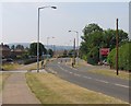
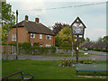
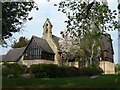
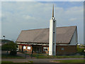
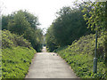
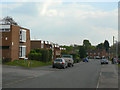
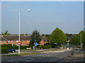
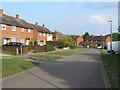
Photos of LE11 0GE

Area Information
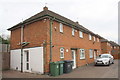
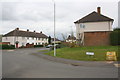
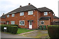
Living in LE11 0GE means being part of a small, tightly knit residential cluster in England, home to 1,471 residents. The area’s compact nature fosters a sense of community, with a median age of 47 and a population skewed toward adults aged 30–64. This suggests a stable, family-oriented demographic, with 82% of homes owned by residents rather than rented. The area’s proximity to schools, rail links, and retail hubs makes it practical for daily life, while its low crime risk and absence of environmental constraints like flood zones or protected landscapes add to its appeal. LE11 0GE is not a sprawling suburb but a focused neighbourhood where convenience and safety are prioritised. Its limited size means it is ideal for those seeking a quiet, established residential environment without the sprawl of larger towns. The area’s blend of local amenities and access to regional infrastructure, such as Loughborough’s rail network and East Midlands Airport, ensures it balances seclusion with connectivity.
- Area Type
- Postcode
- Area Size
- Not available
- Population
- 1471
- Population Density
- 3037 people/km²
The property market in LE11 0GE is characterised by high home ownership (82%) and a predominance of houses over flats or apartments. This suggests a residential area tailored to families and individuals seeking more spacious, long-term living solutions. With no data on rental properties, it appears the market is not driven by short-term lettings but by owner-occupiers. The small size of the area means the housing stock is limited, likely consisting of semi-detached or detached homes typical of rural or semi-rural settings. Buyers should consider the proximity to local amenities and schools, which may influence property values. The lack of planning constraints, such as protected landscapes or flood zones, adds to the area’s appeal for those seeking a low-risk, stable investment. However, the limited size of LE11 0GE means the immediate surroundings may offer similar housing types, requiring buyers to look further afield for diversity in property options.
House Prices in LE11 0GE
No properties found in this postcode.
Energy Efficiency in LE11 0GE
Daily life in LE11 0GE is supported by a range of nearby amenities, including five retail outlets such as Co-op UNIF, Co-op Knighthorpe, and Spar, ensuring access to groceries and everyday essentials. The area’s rail and metro connections to Loughborough and surrounding towns facilitate commuting, while East Midlands Airport provides regional travel options. Though the data does not specify parks or leisure facilities, the presence of multiple retail and transport hubs suggests a practical, convenience-driven lifestyle. The compact nature of the area means residents can access these amenities without long journeys, fostering a self-contained community. The mix of local shops, transport links, and proximity to larger towns like Loughborough ensures a balance between seclusion and accessibility, making LE11 0GE ideal for those seeking a quiet yet connected way of life.
Amenities
Schools
Residents of LE11 0GE have access to several schools, including Charnwood College (Upper) and Charnwood College (High), both primary schools, and Charnwood College, an academy with a ‘good’ Ofsted rating. The presence of two primary schools ensures younger children have local options, while the academy provides secondary education with a proven standard of teaching. The mix of primary and academy schools offers families a range of educational pathways, from early years to higher education. The ‘good’ rating at Charnwood College indicates a school that meets national standards in teaching quality and student outcomes. For parents prioritising school proximity and performance, this cluster of institutions provides a solid foundation for children’s education. The lack of data on other schools in the area means these are the primary options available, reinforcing the importance of proximity to these establishments for families.
| Rank | School | Type | Entry gender | Ages |
|---|
Explore more schools in this area
Go to Schools tabDemographics
The population of LE11 0GE is 1,471, with a median age of 47, reflecting a mature demographic. The majority of residents are adults aged 30–64, indicating a community of settled families and professionals. Home ownership is high at 82%, suggesting long-term residency and financial stability. The area is predominantly composed of houses, which aligns with the age profile of homeowners seeking more space than flats. The predominant ethnic group is White, with no specific data on other demographics provided. The high home ownership rate and age distribution imply a low turnover of residents, contributing to a stable, familiar community. The absence of detailed diversity statistics means the area’s cultural composition remains less defined, but the focus on family-oriented living is clear. For those prioritising a quiet, established neighbourhood with strong property values, LE11 0GE offers a straightforward, predictable environment.
Household Size
Accommodation Type
Tenure
Ethnic Group
Religion
Household Composition
Age
Household Deprivation
NS-SEC
Explore more demographic insights in this area
Go to Demographics tabPlanning
Planning Constraints
- Flood RiskPremium
- Ramsar Wetland SitesPremium
- Area of Outstanding Natural BeautyPremium
- Protected Nature ReservePremium
- Protected WoodlandPremium