Area Overview for LE10 2YR
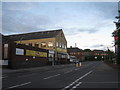
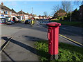
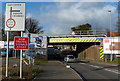
Photos of LE10 2YR


Area Information
Living in LE10 2YR means being part of a small, tightly knit residential cluster in England, home to 1,992 people. This area is characterised by its modest scale and proximity to Hinckley, a town known for its historic market and growing retail presence. The community here skews older, with a median age of 47 and a majority of residents aged 30–64. Daily life is shaped by the local infrastructure, including nearby schools, rail links, and a mix of retail outlets. While the area lacks large-scale amenities, its compact nature makes it practical for those prioritising convenience over sprawling urban sprawl. The housing stock is dominated by individual homes, with 46% of properties owner-occupied. This suggests a balance between long-term residents and those renting in the area. LE10 2YR is not a high-risk zone for flooding or environmental constraints, but its crime risk is elevated, requiring residents to remain vigilant. For buyers, this postcode offers a quiet, low-maintenance lifestyle with direct access to essential services, though its small size means property choices are limited to the immediate vicinity.
- Area Type
- Postcode
- Area Size
- Not available
- Population
- 1992
- Population Density
- 4123 people/km²
The property market in LE10 2YR is defined by its focus on individual homes, with no flats or apartments present. At 46% home ownership, the area is not heavily dominated by owner-occupiers, indicating a notable rental market. This suggests that while some residents live in properties they own, a substantial portion of the housing stock is let out to tenants. The absence of high-density housing means the area is unlikely to attract buyers seeking investment properties or rental portfolios. For those considering purchasing, the small size of the postcode means the housing stock is limited to the immediate vicinity, requiring buyers to look beyond LE10 2YR for larger options. The predominance of houses over other property types also means that buyers should expect larger plots and potentially higher maintenance costs. This market dynamic may make the area more appealing to families or retirees seeking a quiet, low-traffic environment rather than investors.
House Prices in LE10 2YR
No properties found in this postcode.
Energy Efficiency in LE10 2YR
The lifestyle in LE10 2YR is shaped by its proximity to retail and transport hubs. Within practical reach are Sainsburys Hinckley, Lidl Hinckley, and Aldi Holliers, providing everyday shopping needs. The rail network, including Hinckley and Bermuda Park stations, ensures easy access to nearby towns for leisure or work. While the area does not have large parks or recreational facilities, its small size means residents can reach larger green spaces in Hinckley. The retail options cater to daily essentials, though those seeking a wider range of dining or entertainment may need to travel further. The combination of shops, rail links, and nearby schools creates a self-contained environment, ideal for those prioritising convenience over sprawling urban amenities.
Amenities
Schools
Residents of LE10 2YR have access to several schools within practical reach. St Mary’s Church of England Primary School in Hinckley holds an Ofsted rating of ‘good’, offering a solid foundation for younger children. Saint Peter’s Catholic Primary School, also in Hinckley, provides an alternative faith-based education, while Saint Peter’s Catholic Primary School, A Voluntary Academy, offers similar options. The Midland Studio College Hinckley caters to secondary education, though its specific Ofsted rating is not listed. The mix of Church of England, Catholic, and state-run schools gives families a range of educational choices, though the absence of independent or specialist schools may be a limitation. The proximity of these institutions suggests that families with children can rely on local provisions, though the lack of detailed performance data for secondary schools may require further investigation.
| Rank | School | Type | Entry gender | Ages |
|---|
Explore more schools in this area
Go to Schools tabDemographics
The population of LE10 2YR is 1,992, with a median age of 47. This indicates a mature demographic, with the largest age group being adults aged 30–64. The area is predominantly home-owning, with 46% of residents owning their properties. The accommodation type is exclusively houses, suggesting a lack of high-rise or apartment blocks. The predominant ethnic group is White, with no specific data on other ethnicities provided. The age profile implies a community with established careers and families, though the absence of younger demographics may affect local schools and amenities. The home ownership rate of 46% points to a significant rental market, which could influence property prices and availability. This data also suggests that the area is not heavily populated by students or younger professionals, but rather by those seeking stability. The lack of diversity data means the community’s cultural composition remains unclear, though it aligns with broader trends in similar rural and semi-urban areas.
Household Size
Accommodation Type
Tenure
Ethnic Group
Religion
Household Composition
Age
Household Deprivation
NS-SEC
Explore more demographic insights in this area
Go to Demographics tabPlanning
Planning Constraints
- Flood RiskPremium
- Ramsar Wetland SitesPremium
- Area of Outstanding Natural BeautyPremium
- Protected Nature ReservePremium
- Protected WoodlandPremium