Area Overview for LE10 2QP
Photos of LE10 2QP
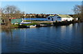
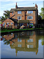
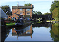
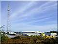
111 photos from this area
Area Information
Key information about the LE10 2QP including its size, population, and administrative classification.
- Area Type
- Postcode
- Area Size
- 3.4 hectares
- Population
- 2514
- Population Density
- 1343 people/km²
House Prices in LE10 2QP
70
Properties
£194,340
Average Sold Price
£119,000
Lowest Price
£300,000
Highest Price
Showing 70 properties
| Address | Type | Beds | Baths | Last Sale Price | Last Sale Date | |
|---|---|---|---|---|---|---|
| 25 Slate Drive, Burbage, LE10 2QP | Semi-detached | 4 | 3 | £280,000 | Nov 2025 | |
| 34 Slate Drive, Burbage, LE10 2QP | Detached | 3 | 2 | £285,000 | Aug 2025 | |
| 53 Slate Drive, Burbage, LE10 2QP | Semi-detached | 2 | 1 | £148,750 | Jan 2025 | |
| 27 Slate Drive, Burbage, LE10 2QP | Detached | 3 | 3 | £295,500 | Nov 2024 | |
| 10 Slate Drive, Burbage, LE10 2QP | Detached | 3 | 3 | £285,000 | Oct 2024 | |
| 93 Slate Drive, Burbage, LE10 2QP | Semi-detached | 4 | 2 | £300,000 | Jun 2024 | |
| 61 Slate Drive, Burbage, LE10 2QP | Semi-detached | 3 | 2 | £191,000 | Jun 2024 | |
| 20 Slate Drive, Burbage, LE10 2QP | house | - | - | £245,000 | Mar 2024 | |
| 43 Slate Drive, Burbage, LE10 2QP | Terraced | 2 | 1 | £189,000 | Mar 2024 | |
| 16 Slate Drive, Burbage, LE10 2QP | Semi-detached | 2 | 1 | £205,000 | Feb 2024 |
Page 1 of 7
Energy Efficiency in LE10 2QP
Amenities
Schools
| Rank | School | Type | Entry gender | Ages |
|---|
Explore more schools in this area
Go to Schools tabDemographics
Household Size
Two person
most common
Accommodation Type
Houses
most common
Tenure
90
majority
Ethnic Group
White
most common
Religion
N/A
most common
Household Composition
N/A
most common
Age
47
median
Adults (30-64 years)
most common
Household Deprivation
N/A
with no deprivation
NS-SEC
46
in Lower managerial occupations
Explore more demographic insights in this area
Go to Demographics tabPlanning
Planning Constraints
- Flood RiskPremium
- Ramsar Wetland SitesPremium
- Area of Outstanding Natural BeautyPremium
- Protected Nature ReservePremium
- Protected WoodlandPremium