Area Overview for LE10 2LD
Photos of LE10 2LD
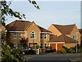
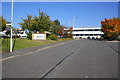
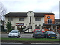
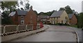
15 photos from this area
Area Information
Key information about the LE10 2LD including its size, population, and administrative classification.
- Area Type
- Postcode
- Area Size
- 1.5 hectares
- Population
- 1937
- Population Density
- 1342 people/km²
House Prices in LE10 2LD
17
Properties
£273,896
Average Sold Price
£99,750
Lowest Price
£410,000
Highest Price
Showing 17 properties
| Address | Type | Beds | Baths | Last Sale Price | Last Sale Date | |
|---|---|---|---|---|---|---|
| 16 Crownhill Road, Burbage, LE10 2LD | Detached | 4 | 3 | £410,000 | Jul 2024 | |
| 18 Crownhill Road, Burbage, LE10 2LD | Detached | 4 | 2 | £385,000 | Dec 2017 | |
| 12 Crownhill Road, Burbage, LE10 2LD | Detached | 4 | 2 | £378,500 | Dec 2017 | |
| 11 Crownhill Road, Burbage, LE10 2LD | Detached | 4 | 2 | £319,950 | Nov 2013 | |
| 9 Crownhill Road, Burbage, LE10 2LD | Detached | 5 | 2 | £350,000 | Nov 2013 | |
| 14 Crownhill Road, Burbage, LE10 2LD | house | - | - | £250,000 | Aug 2010 | |
| 3 Crownhill Road, Burbage, LE10 2LD | Bungalow | 3 | 1 | £210,000 | Sep 2009 | |
| 10 Crownhill Road, Burbage, LE10 2LD | house | - | - | £312,500 | Aug 2007 | |
| 15 Crownhill Road, Burbage, LE10 2LD | hospital_care_home | 5 | - | £325,000 | Sep 2006 | |
| 7 Crownhill Road, Burbage, LE10 2LD | house | - | - | £195,000 | May 2004 |
Page 1 of 2
Energy Efficiency in LE10 2LD
Amenities
Schools
| Rank | School | Type | Entry gender | Ages |
|---|
Explore more schools in this area
Go to Schools tabDemographics
Household Size
Family (3-5 people)
most common
Accommodation Type
Houses
most common
Tenure
89
majority
Ethnic Group
White
most common
Religion
N/A
most common
Household Composition
N/A
most common
Age
47
median
Adults (30-64 years)
most common
Household Deprivation
N/A
with no deprivation
NS-SEC
48
in Lower managerial occupations
Explore more demographic insights in this area
Go to Demographics tabPlanning
Planning Constraints
- Flood RiskPremium
- Ramsar Wetland SitesPremium
- Area of Outstanding Natural BeautyPremium
- Protected Nature ReservePremium
- Protected WoodlandPremium