Area Overview for LE10 2JA
Photos of LE10 2JA
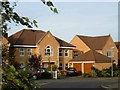
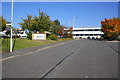
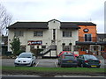
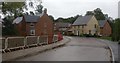
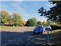
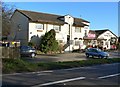
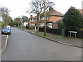
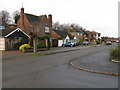
15 photos from this area
Area Information
Key information about the LE10 2JA including its size, population, and administrative classification.
- Area Type
- Postcode
- Area Size
- 9903 m²
- Population
- 1937
- Population Density
- 1342 people/km²
House Prices in LE10 2JA
36
Properties
£179,213
Average Sold Price
£41,500
Lowest Price
£310,000
Highest Price
Showing 36 properties
| Address | Type | Beds | Baths | Last Sale Price | Last Sale Date | |
|---|---|---|---|---|---|---|
| 53 Newstead Avenue, Burbage, LE10 2JA | Semi-detached | 3 | 1 | £265,000 | Nov 2025 | |
| 71 Newstead Avenue, Burbage, LE10 2JA | Bungalow | 2 | 1 | £310,000 | Mar 2025 | |
| 5 Newstead Avenue, Burbage, LE10 2JA | Terraced | 3 | 1 | £245,000 | Dec 2024 | |
| 17 Newstead Avenue, Burbage, LE10 2JA | Semi-detached | 2 | 1 | £230,000 | Oct 2024 | |
| 61 Newstead Avenue, Burbage, LE10 2JA | Semi-detached | 3 | 1 | £265,000 | May 2024 | |
| 29 Newstead Avenue, Burbage, LE10 2JA | Semi-detached | - | - | £120,000 | May 2023 | |
| 33 Newstead Avenue, Burbage, LE10 2JA | Semi-detached | 2 | 1 | £242,500 | Nov 2022 | |
| 31 Newstead Avenue, Burbage, LE10 2JA | Semi-detached | 2 | 2 | £225,000 | Aug 2022 | |
| 47 Newstead Avenue, Burbage, LE10 2JA | Semi-detached | 3 | 1 | £236,000 | Aug 2020 | |
| 43 Newstead Avenue, Burbage, LE10 2JA | Semi-detached | 3 | 2 | £240,000 | Jul 2020 |
Page 1 of 4
Energy Efficiency in LE10 2JA
Amenities
Schools
| Rank | School | Type | Entry gender | Ages |
|---|
Explore more schools in this area
Go to Schools tabDemographics
Household Size
Family (3-5 people)
most common
Accommodation Type
Houses
most common
Tenure
89
majority
Ethnic Group
White
most common
Religion
N/A
most common
Household Composition
N/A
most common
Age
47
median
Adults (30-64 years)
most common
Household Deprivation
N/A
with no deprivation
NS-SEC
48
in Lower managerial occupations
Explore more demographic insights in this area
Go to Demographics tabPlanning
Planning Constraints
- Flood RiskPremium
- Ramsar Wetland SitesPremium
- Area of Outstanding Natural BeautyPremium
- Protected Nature ReservePremium
- Protected WoodlandPremium