Area Overview for LE10 2DA
Photos of LE10 2DA
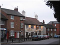
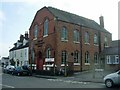
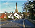
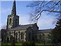
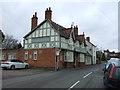
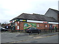
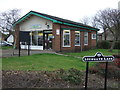
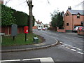
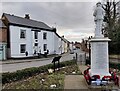
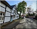
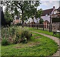
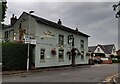
38 photos from this area
Area Information
Key information about the LE10 2DA including its size, population, and administrative classification.
- Area Type
- Postcode
- Area Size
- 8069 m²
- Population
- 1566
- Population Density
- 2607 people/km²
House Prices in LE10 2DA
28
Properties
£270,430
Average Sold Price
£68,000
Lowest Price
£750,000
Highest Price
Showing 28 properties
| Address | Type | Beds | Baths | Last Sale Price | Last Sale Date | |
|---|---|---|---|---|---|---|
| 31 Church Street, Burbage, LE10 2DA | Terraced | 3 | 1 | £220,000 | Jul 2024 | |
| 55 Church Street, Burbage, LE10 2DA | house | 3 | 1 | £335,000 | Apr 2024 | |
| 73 Church Street, Burbage, LE10 2DA | Cottage | 2 | 1 | £750,000 | Nov 2022 | |
| 57 Church Street, Burbage, LE10 2DA | house | 3 | 2 | £345,000 | Nov 2022 | |
| 51 Church Street, Burbage, LE10 2DA | Terraced | 3 | 1 | £305,000 | Sep 2022 | |
| 27 Church Street, Burbage, LE10 2DA | Detached | 3 | 1 | £200,000 | Aug 2022 | |
| 47 Church Street, Burbage, LE10 2DA | Cottage | 3 | - | £365,000 | Nov 2020 | |
| 49 Church Street, Burbage, LE10 2DA | Terraced | 4 | 1 | £390,000 | Jul 2019 | |
| 67 Church Street, Burbage, LE10 2DA | house | - | - | £600,000 | May 2018 | |
| 23 Church Street, Burbage, LE10 2DA | Terraced | 3 | 1 | £263,000 | May 2018 |
Page 1 of 3
Energy Efficiency in LE10 2DA
Amenities
Schools
| Rank | School | Type | Entry gender | Ages |
|---|
Explore more schools in this area
Go to Schools tabDemographics
Household Size
Two person
most common
Accommodation Type
Houses
most common
Tenure
67
majority
Ethnic Group
White
most common
Religion
N/A
most common
Household Composition
N/A
most common
Age
47
median
Adults (30-64 years)
most common
Household Deprivation
N/A
with no deprivation
NS-SEC
38
in Lower managerial occupations
Explore more demographic insights in this area
Go to Demographics tabPlanning
Planning Constraints
- Flood RiskPremium
- Ramsar Wetland SitesPremium
- Area of Outstanding Natural BeautyPremium
- Protected Nature ReservePremium
- Protected WoodlandPremium