Area Overview for LE10 0ZP
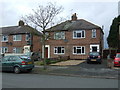
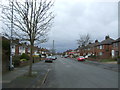
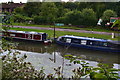
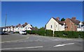
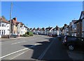
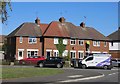
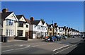
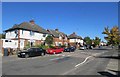
Photos of LE10 0ZP
Area Information
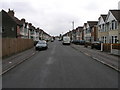
Living in LE10 0ZP means being part of a small, tightly knit residential cluster in England, where the population of 1,271 residents creates a quiet, community-focused environment. This postcode area is characterised by its modest scale, with homes predominantly in the form of detached or semi-detached houses. The median age of 47 suggests a mature demographic, with adults aged 30–64 making up the largest share of the population. Daily life here is likely shaped by proximity to nearby amenities, including retail outlets and railway stations, which provide practical access to services and commuting options. While the area lacks large-scale infrastructure, its compact nature fosters a sense of familiarity and ease of navigation. The absence of major planning constraints, such as protected woodlands or Areas of Outstanding Natural Beauty, means development is not restricted, though the low flood risk score of 0 indicates minimal environmental threat. For those seeking a balanced lifestyle with access to essential services without the hustle of urban centres, LE10 0ZP offers a straightforward, low-maintenance living experience.
- Area Type
- Postcode
- Area Size
- Not available
- Population
- 1271
- Population Density
- 4422 people/km²
The property market in LE10 0ZP is defined by a 46% home ownership rate, indicating that nearly half of properties are owner-occupied, while the remaining 54% are likely rented. The accommodation type is predominantly houses, which suggests a focus on single-family homes rather than apartments or flats. This composition aligns with the area’s mature demographic, where older residents may prefer the privacy and space of a house. The small scale of the postcode area means the housing stock is limited, which could make the market competitive for buyers. For those seeking a home, the availability of houses may appeal to families or individuals desiring more living space, though the lack of high-density housing options means rental opportunities are likely fewer. The absence of significant planning constraints, such as protected land or environmental restrictions, may also make the area more attractive to developers or buyers looking for flexibility in property use.
House Prices in LE10 0ZP
No properties found in this postcode.
Energy Efficiency in LE10 0ZP
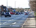
Residents of LE10 0ZP have access to a range of nearby amenities, including five retail outlets such as Lidl Hinckley, Sainsburys Hinckley, and Co-op Burbage, which provide essential shopping and grocery services. The area’s proximity to four railway stations—Hinckley, Nuneaton, Bermuda Park, and Shenton—offers convenient travel options for commuting or leisure trips. While the postcode itself is small, the surrounding area includes a mix of retail, dining, and transport hubs, allowing residents to meet daily needs without long journeys. The lack of detailed information on parks or leisure facilities means the area’s recreational opportunities are unclear, but the presence of multiple rail links and retail options suggests a functional, if modest, lifestyle. For those prioritising convenience over expansive amenities, LE10 0ZP provides a practical base with access to nearby services and transport networks.
Amenities
Schools
The nearest school to LE10 0ZP is Westfield Junior School, a primary school with an Ofsted rating of ‘good’. This single primary school serves the area’s children, though the lack of secondary schools or other educational institutions within the postcode means families may need to travel to nearby towns for secondary education. The presence of a ‘good’-rated primary school is a positive factor for families prioritising quality education, but the absence of additional schools—such as secondary or special needs provision—could be a limitation. For parents seeking a full range of educational options, proximity to other schools in the surrounding area, such as those in Hinckley or Nuneaton, would be essential. The single school in the data highlights the need for careful planning when considering LE10 0ZP as a family home.
| Rank | School | Type | Entry gender | Ages |
|---|
Explore more schools in this area
Go to Schools tabDemographics
The community in LE10 0ZP is predominantly composed of adults aged 30–64, with a median age of 47, reflecting a mature, stable population. Home ownership stands at 46%, suggesting a mix of owner-occupied properties and rental units, though the exact proportion of renters is not specified. The area is largely composed of houses, which aligns with the demographic profile of older, established residents. The predominant ethnic group is White, with no data provided on other ethnicities or diversity metrics. This demographic structure implies a community with long-term residents and fewer transient populations. The absence of specific data on deprivation levels means the quality of life cannot be fully contextualised, but the low flood risk and proximity to amenities like schools and retail suggest a functional, if unremarkable, living environment. For buyers, this profile indicates a steady, low-volatility market with homes suited to those prioritising stability over novelty.
Household Size
Accommodation Type
Tenure
Ethnic Group
Religion
Household Composition
Age
Household Deprivation
NS-SEC
Explore more demographic insights in this area
Go to Demographics tabPlanning
Planning Constraints
- Flood RiskPremium
- Ramsar Wetland SitesPremium
- Area of Outstanding Natural BeautyPremium
- Protected Nature ReservePremium
- Protected WoodlandPremium