Area Overview for LE10 0TF
Photos of LE10 0TF

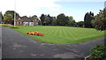
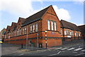
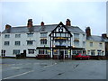
95 photos from this area
Area Information
Key information about the LE10 0TF including its size, population, and administrative classification.
- Area Type
- Postcode
- Area Size
- 5823 m²
- Population
- 1359
- Population Density
- 3745 people/km²
House Prices in LE10 0TF
12
Properties
£207,188
Average Sold Price
£66,500
Lowest Price
£350,000
Highest Price
Showing 12 properties
| Address | Type | Beds | Baths | Last Sale Price | Last Sale Date | |
|---|---|---|---|---|---|---|
| 36 St Georges Avenue, Hinckley, LE10 0TF | Bungalow | 2 | 1 | £235,000 | May 2021 | |
| 34 St Georges Avenue, Hinckley, LE10 0TF | Bungalow | 3 | 2 | £350,000 | Nov 2020 | |
| 32 St Georges Avenue, Hinckley, LE10 0TF | house | - | - | £295,000 | Oct 2017 | |
| 36A St Georges Avenue, Hinckley, LE10 0TF | Detached | 3 | 3 | £259,000 | Jun 2017 | |
| 30 St Georges Avenue, Hinckley, LE10 0TF | Detached | - | - | £160,000 | Jan 2015 | |
| 38 St Georges Avenue, Hinckley, LE10 0TF | Bungalow | - | - | £135,000 | Feb 2013 | |
| 50 St Georges Avenue, Hinckley, LE10 0TF | house | 3 | - | £157,000 | Aug 2010 | |
| 48 St Georges Avenue, Hinckley, LE10 0TF | Semi-detached | - | - | £66,500 | Oct 1999 | |
| 42 St Georges Avenue, Hinckley, LE10 0TF | Detached | 4 | 2 | - | - | |
| 52 St Georges Avenue, Hinckley, LE10 0TF | Semi-detached | - | - | - | - |
Page 1 of 2
Energy Efficiency in LE10 0TF
Amenities
Schools
| Rank | School | Type | Entry gender | Ages |
|---|
Explore more schools in this area
Go to Schools tabDemographics
Household Size
Two person
most common
Accommodation Type
Houses
most common
Tenure
86
majority
Ethnic Group
White
most common
Religion
N/A
most common
Household Composition
N/A
most common
Age
47
median
Adults (30-64 years)
most common
Household Deprivation
N/A
with no deprivation
NS-SEC
33
in Lower managerial occupations
Explore more demographic insights in this area
Go to Demographics tabPlanning
Planning Constraints
- Flood RiskPremium
- Ramsar Wetland SitesPremium
- Area of Outstanding Natural BeautyPremium
- Protected Nature ReservePremium
- Protected WoodlandPremium