Area Overview for LE1 6DB
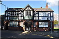
Photos of LE1 6DB


Area Information
Living in LE1 6DB means being part of a small, tightly knit residential cluster in England, home to 2,783 residents. This area is characterised by its compact nature, with a population skewed towards young adults aged 15–29, reflecting a dynamic, often student-driven community. The proximity to De Montfort University adds a distinct academic energy, though the area itself is more residential than campus-based. Daily life here is shaped by its limited size, with amenities and transport options clustered closely. Residents benefit from easy access to multiple rail stations, including Leicester and South Wigston, as well as nearby metro links like Great Central Railway. While the broadband score of 74 and mobile coverage of 85 ensure reliable digital connectivity, the area’s safety profile is a concern, with a crime risk rating of 1/100. Despite this, LE1 6DB offers a practical, no-frills lifestyle for those prioritising convenience over sprawling urban spaces. Its small footprint means a strong sense of community, though the low home ownership rate (10%) suggests most residents are renters. For buyers, the area’s compactness and proximity to transport hubs may appeal, though the limited housing stock of flats could restrict options.
- Area Type
- Postcode
- Area Size
- Not available
- Population
- 2783
- Population Density
- 12849 people/km²
The property market in LE1 6DB is defined by its low home ownership rate (10%) and reliance on flats as the primary accommodation type. This suggests a rental-dominated market with limited owner-occupied properties, likely due to the area’s small size and focus on transient populations such as students. The scarcity of larger homes indicates that the housing stock is not suited for growing families or long-term residency. For buyers, this means few opportunities to purchase property within LE1 6DB itself, though nearby areas may offer more options. The flat-based market also implies a focus on affordability and functional living spaces rather than luxury or spaciousness. Given the area’s compact nature, property values are unlikely to be high, but the lack of data on specific prices or trends means this remains speculative. Buyers should consider the limited housing stock and the area’s transient demographic when evaluating long-term viability.
House Prices in LE1 6DB
No properties found in this postcode.
Energy Efficiency in LE1 6DB
Residents of LE1 6DB have access to a range of nearby amenities, including three Tesco stores—Welford, Leicester, and Haymarket—offering shopping convenience. The area’s rail and metro links, such as Leicester North and Syston stations, provide easy access to larger urban centres, while Leicester Airport adds regional travel options. Though the data does not specify parks or leisure facilities, the presence of multiple retail outlets and transport hubs suggests a practical, service-oriented lifestyle. The compact nature of the area means amenities are closely clustered, reducing travel time for daily needs. However, the absence of named parks or recreational spaces indicates a focus on functional rather than leisurely living. For those prioritising convenience over expansive green spaces, LE1 6DB offers a straightforward, no-nonsense approach to daily life, with shopping and transport needs met within a short reach.
Amenities
Schools
The only named educational institution near LE1 6DB is De Montfort University, categorised as an "other" type in the data. This suggests the area lacks primary or secondary schools, which could be a challenge for families with children requiring local education. The absence of listed schools for younger age groups means residents may need to travel to nearby areas for schooling, though the proximity to Leicester—a larger city—might offer more options. The presence of a university, however, could attract students and academics, contributing to the area’s youthful demographic. For families, the lack of local schools may necessitate a reliance on transport links to reach educational institutions, which is feasible given the area’s rail and metro connectivity. The data does not provide Ofsted ratings or further details on the university’s offerings, so prospective residents should investigate independently.
| Rank | School | Type | Entry gender | Ages |
|---|
Explore more schools in this area
Go to Schools tabDemographics
The community in LE1 6DB is overwhelmingly young, with a median age of 22 and 80% of residents falling within the 15–29 age range. This demographic skew suggests a population dominated by students, young professionals, or those in early careers. Home ownership is exceptionally low at 10%, indicating that most residents are renters, likely drawn to the area’s affordability or proximity to education. The accommodation type is almost entirely flats, reflecting a lack of larger family homes. The predominant ethnic group is White, though no data is provided on the presence of other ethnicities. The low home ownership rate and young age profile suggest a transient population, with limited long-term residency. This dynamic has implications for quality of life: while the area may offer affordability and convenience, it may lack the stability of more established communities. The absence of detailed diversity data means the full picture of social composition remains unclear, but the demographic profile is undeniably youthful and mobile.
Household Size
Accommodation Type
Tenure
Ethnic Group
Religion
Household Composition
Age
Household Deprivation
NS-SEC
Explore more demographic insights in this area
Go to Demographics tabPlanning
Planning Constraints
- Flood RiskPremium
- Ramsar Wetland SitesPremium
- Area of Outstanding Natural BeautyPremium
- Protected Nature ReservePremium
- Protected WoodlandPremium