Area Overview for LE1 3NG
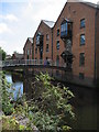
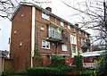
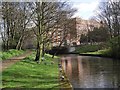
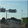
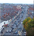
Photos of LE1 3NG


Area Information
Living in LE1 3NG means being part of a small, tightly knit residential cluster in England, home to 2,463 people. This area is defined by its compact size and proximity to essential services, making it a practical choice for those prioritising convenience. The community is young, with a median age of 22, and the most common age range is adults between 30 and 64 years. This suggests a mix of established residents and families, though the low home ownership rate of 24% indicates a significant portion of the population rents. Flats dominate the accommodation type, reflecting the area’s density. LE1 3NG is served by a range of schools, including a primary school with a good Ofsted rating, and nearby independent options. The area’s digital connectivity is strong, with a broadband score of 100, and practical rail links to Leicester and surrounding towns. While the population is small, the presence of retail outlets like Tesco and Lidl, plus multiple railway stations, ensures daily life is well-supported. However, the medium crime risk score of 62 means residents should remain mindful of standard security measures.
- Area Type
- Postcode
- Area Size
- Not available
- Population
- 2463
- Population Density
- 12068 people/km²
The property market in LE1 3NG is characterised by a low home ownership rate of 24%, which implies that the area is primarily a rental market rather than one dominated by owner-occupied homes. The accommodation type is predominantly flats, reflecting the area’s density and compact layout. This suggests that property options are limited to smaller, often multi-unit buildings, which may appeal to renters seeking affordability and convenience. For buyers, the small size of the area and the focus on flats mean there are fewer opportunities for larger homes or land purchases. However, the proximity to rail networks and retail hubs could make it an attractive option for investors targeting rental income. The lack of significant planning constraints, such as protected woodlands or AONB areas, may also make the area more adaptable to development. Nonetheless, the limited housing stock and high rental demand could create competition for available properties.
House Prices in LE1 3NG
No properties found in this postcode.
Energy Efficiency in LE1 3NG
The lifestyle in LE1 3NG is supported by a range of nearby amenities, including retail outlets like Tesco Belgrave, Iceland Leicester, and Lidl Central, which provide everyday shopping convenience. The area’s rail network connects residents to Leicester and beyond, with stations such as Leicester Railway Station offering direct links to major cities. The presence of Leicester Airport further enhances accessibility for regional and national travel. While the area lacks extensive parks or leisure facilities, the proximity to rail and retail hubs suggests a focus on practicality over expansive recreational spaces. The mix of shops, transport options, and the absence of major environmental constraints create a functional living environment. However, the limited availability of green spaces may be a consideration for those prioritising outdoor activities. Overall, the area’s amenities cater to daily needs without requiring long commutes.
Amenities
Schools
Residents of LE1 3NG have access to a range of educational institutions, including Taylor Road Primary School, which holds a good Ofsted rating. This state-funded primary school provides a reliable option for younger families, while the nearby Al-Ihsaan Community College offers an independent alternative. The mix of state and independent schools allows families to choose between publicly funded education and fee-paying options, catering to different preferences and financial circumstances. The presence of a primary school with a strong rating is a significant advantage for parents prioritising quality education. However, the absence of secondary school data means it is unclear whether the area’s secondary education options are similarly robust. The proximity of these schools to LE1 3NG ensures that children can attend without long commutes, supporting a family-friendly environment.
| Rank | School | Type | Entry gender | Ages |
|---|
Explore more schools in this area
Go to Schools tabDemographics
The demographic profile of LE1 3NG is shaped by a median age of 22, though the most common age group is adults aged 30–64. This suggests a community with a balance of younger individuals and middle-aged residents, possibly reflecting a mix of students, professionals, and families. Home ownership is low, at 24%, indicating that the majority of residents are likely renting. The predominant accommodation type is flats, which aligns with the area’s compact nature. The largest ethnic group is the Asian community, as recorded in the data. This diversity contributes to the area’s cultural character. The absence of specific deprivation data means it is unclear how economic factors influence quality of life, but the presence of nearby amenities and good digital connectivity suggests accessibility to services. The mix of age groups and housing types creates a dynamic but manageable community, though the low home ownership rate may indicate limited long-term investment in property.
Household Size
Accommodation Type
Tenure
Ethnic Group
Religion
Household Composition
Age
Household Deprivation
NS-SEC
Explore more demographic insights in this area
Go to Demographics tabPlanning
Planning Constraints
- Flood RiskPremium
- Ramsar Wetland SitesPremium
- Area of Outstanding Natural BeautyPremium
- Protected Nature ReservePremium
- Protected WoodlandPremium