Area Overview for Langwith
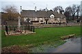
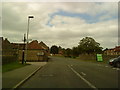
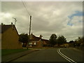
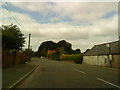
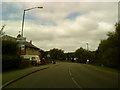
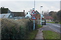
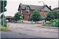
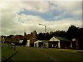
Photos of Langwith


Area Information
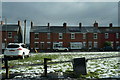
Living in Langwith means settling into a compact built-up area covering 92.6 hectares in England. This town presents a contained community experience rather than the sprawling feel of a larger city. The area sits quietly with a median age of 70, which suggests a retirement-dominant population structure. You are looking at a place where daily life moves at a slower pace compared to urban centres. The housing stock reflects this demographic as owners make up a significant majority of residents. Most people who call Langwith home have decided to buy rather than rent. This stability often points towards established occupied properties tailored to older households. The town functions as a self-contained neighbourhood for its residents. While Langwith remains a small town, it benefits from practical access to wider facilities in nearby centres. Shirebrook and Creswell serve as commercial hubs for your shopping and transport needs. The population composition is heavily weighted towards those aged 70 years or over. This creates a distinct character where community interaction focuses on the needs of a mature demographic. When you consider homes in Langwith, you are entering an area defined by stability and quiet ownership. The sixty percent home ownership rate confirms that the area succeeds as a place for settling down rather than a transient rental market.
- Area Type
- Built Up Area 250
- Area Size
- 92.6 hectares
- Population
- Not available
- Population Density
- Not available
Your daily lifestyle in Langwith centres on access to specific retail outlets and rail networks rather than a high street within the town itself. Five major retail outlets lie within practical reach, providing essential shopping convenience. You can find Aldi Shirebrook, Co-op Shirebrook, and Lidl Shirebrook nearby. These three supermarkets alone cover almost all your weekly grocery shopping requirements. The area also boasts five railway stations nearby, ensuring reliable transport links. Langwith, Shirebrook Railway Station and Creswell Railway Station serve as key interchange points. From here, you can connect to broader regional networks without needing a private vehicle for every journey. This transport mix supports a balanced life between town house living and country town convenience. Neighbouring areas provide the bulk of your leisure and dining options, as Langwith itself is a small built-up area of 92.6 hectares. You do not need extensive leisure amenities within your immediate doorstep because the infrastructure is designed for efficient access to larger centres. Shopping sprees, grocery runs, and train commutes become straightforward tasks when Aldi Shirebrook and Co-op Shirebrook are so close. The presence of rail stations near Creswell and Shirebrook means you have career and social options beyond the town limits.
Amenities
Schools
Whaley Thorns County Infant School serves as a primary institution within the catchment area of Langwith. You will find this school listed alongside other facilities named Whaley Thorns Primary School. Whaley Thorns County Junior School completes the local triad of infant, junior, and primary provision. For parents seeking assurance, one record confirms that Whaley Thorns Primary School holds a good Ofsted rating. This rating offers a concrete checkpoint for you when evaluating the quality of local education. The mix of schools available nearby provides a complete cycle from infant to primary stages. Whaley Thorns County Infant School caters to the younger age group before students transition to the junior division. Whaley Thorns County Junior School then handles the upper stages of primary education. Having Whaley Thorns Primary School listed multiple times suggests a concentration of educational resources in this specific locality. A 'good' rating from Ofsted is a significant marker of educational standards in the area. This specific accreditation applies directly to Whaley Thorns Primary School, giving you a named benchmark for quality. The presence of multiple schools under the Whaley Thorns brand indicates a dedicated cluster of learning facilities. When you look at schools near Langwith, this concentration allows for flexibility in where you draw your school run radius. You do not need to travel far to access these educational hubs. The infrastructure supports local families with a range of educational options readily on their doorstep.
| Rank | School | Type | Entry gender | Ages |
|---|
Explore more schools in this area
Go to Schools tabDemographics
The community in Langwith is defined by an older population profile. The median age sits at 70 years, which is a defining characteristic of the town. Most residents fall into the age total category, meaning the demographic data reflects a broad range generally skewed towards the elderly. This age profile influences how life plays out on your street. House ownership stands at 59%, indicating that more than half of all households own their property outright. This high level of ownership breeds a stable and settled neighbourhood atmosphere. Diversity data reaches only general totals in the available records, though the specific ethnicity breakdown requires reference to the aggregate figures provided. The predominant ethnic group statistics are recorded as total, reflecting the composition of the entire population. Similarly, religious affiliation data records the total percentage for the area without a specific dominant breakdown. Accommodation types are also recorded as a total figure, suggesting a mix of housing models that must be viewed in aggregate. You will find that household composition follows the same total classification, meaning the structure of families or single-person households is best understood through the overall census data. These totals allow for a complete picture of the social fabric without fragmentation. The average age of 70 creates a specific rhythm to daily life. Understanding these demographics helps you gauge if Langwith matches your lifestyle expectations. The 59% ownership rate further confirms that the area functions primarily as an owner-occupied community where long-term stability is the norm.
Household Size
Accommodation Type
Tenure
Ethnic Group
Religion
Household Composition
Age
Household Deprivation
NS-SEC
Explore more demographic insights in this area
Go to Demographics tabPlanning
Planning Constraints
- Crime RiskPremium