Area Overview for Langton By Wragby
Photos of Langton By Wragby
Area Information
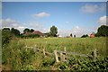
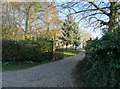
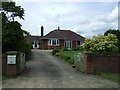
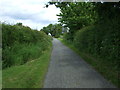
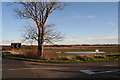
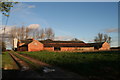
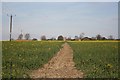
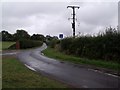
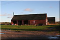
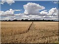
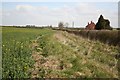
Langton By Wragby is a civil parish situated in England, covering a total area of 9.7 km². Living in this location offers a distinct experience shaped by its rural character and specific constraints. You should be aware that the parish contains protected woodland, which creates a specific planning constraint you must consider before purchasing any property. The area avoids other major environmental restrictions, passing assessments regarding Ramsar wetland sites, Areas of Outstanding Natural Beauty, and protected nature reserves. This means planning Applications face fewer hurdles compared to areas with stricter environmental protections. However, the presence of protected woodland confirms that development is limited by the local geography and ecological value of the land. Daily life here revolves around a tranquil setting defined by its size and nature. The parish is small in spatial terms, yet it houses a community with very different social dynamics from urban centres. You will find that homes in Langton By Wragby are surrounded by green space, but your ability to build extensions or new structures may be restricted by the surrounding woodland. The area stands alone as a distinct geographical entity without the distractions of larger towns. Prospective buyers must appreciate that this specific environment dictates the pace of life and the types of modifications you can make to existing properties.
- Area Type
- Parish
- Area Size
- 9.7 km²
- Population
- Not available
- Population Density
- Not available
Demographics
The community within Langton By Wragby is defined by a remarkably elderly population. The median age here is 70 years, placing it firmly in the demographic of retirees rather than families with young children. Most households consist of older residents, meaning you will find very few schools near Langton By Wragby that cater to primary or secondary age groups. You are looking at an environment where daily life revolves around leisure and quiet rather than youth activities. This demographic profile strongly influences the local economy and the types of services available to you. Home ownership in Langton By Wragby stands at an impressive 72%. This figure indicates that the vast majority of residents own their homes outright or have significant equity. You will rarely encounter buy-to-let rental properties in the parish centres. This high ownership rate suggests a stable, long-term resident base who have chosen to settle down rather than rent transit. The age profile and ownership levels combine to create a very static society. Few people move away or arrive regularly, which fosters a tight-knit social fabric but can also mean fewer new investments or amenities arrive over time. If you are considering living in Langton By Wragby, expect a community where neighbours know each other over decades.
Household Size
Accommodation Type
Tenure
Ethnic Group
Religion
Household Composition
Age
Household Deprivation
NS-SEC
Explore more demographic insights in this area
Go to Demographics tabPlanning
Planning Constraints
- Flood RiskPremium
- Ramsar Wetland SitesPremium
- Area of Outstanding Natural BeautyPremium
- Protected Nature ReservePremium
- Protected WoodlandPremium
- Crime RiskPremium