Area Overview for Langriville
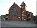
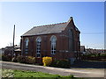
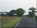
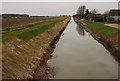
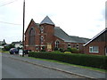
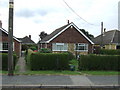
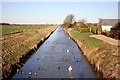
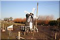
Photos of Langriville
Area Information
Langriville is a civil parish situated within the wider English landscape, covering a total area of 12.3 square kilometres. Living in this parish offers a specific character defined by its size and established community footprint. The location appeals to those seeking a defined rural or semi-rural environment where the land belongs to a distinct administrative entity. You can expect a space that balances private living areas with the broader contours of the parish boundary. The 12.3 km² extent provides enough ground to support local infrastructure while maintaining a manageable scale. This area functions as a complete unit rather than a fragment of a larger town centre. Residents navigate these clear boundaries which help define the locality's identity. The parish structure supports a sense of place through its official designation. You are stepping into an area where the boundaries are clear and the community is anchored by its size. This specific land measurement influences everything from local planning to the daily movement of residents. Living here means accepting the reality of a fixed, measured geography. The area stands as a recognisable entity within the locality. Its status as a civil parish gives it a formal standing in regional administration. You find a clear definition of belonging within these 12.3 square kilometres. The parish label ensures a structured approach to local governance and community representation. This clarity helps you understand the limits and reach of daily life in the parish.
- Area Type
- Parish
- Area Size
- 12.3 km²
- Population
- Not available
- Population Density
- Not available
Demographics
The community within Langriville reflects a settled population with a distinct age profile. The median age stands at 70 years, marking a significant demographic skew towards older residents compared to the national average. This statistic confirms that the parish is home to a mature population rather than families with young children or students. You will find that the majority of households consist of older individuals living alone or in partnerships. Home ownership remains high at 77%, reinforcing the trend of long-term tenure over renting. This level of ownership suggests residents have stayed in the parish for many years, building deep local roots. The accommodation mix primarily serves this older demographic rather than young professionals or mobile families. You should note that the household composition data aligns closely with the median age figure provided. The 77% ownership rate indicates a stable housing stock where people keep their homes rather than moving frequently. This stability creates a quiet environment where neighbours know each other well over decades. The demographic reality means you are joining a community where silence and routine are the norm. Living in Langriville involves adapting to an older social fabric. The lack of data on specific ethnic groups or religious breakdown highlights the mono-cultural or homogeneous nature often found in older parishes. You can rely on the 70-year median as a definitive marker of the social climate. The 77% ownership figure is a concrete measure of local sentiment towards staying put. These numbers define your expectations for who you will meet on the street or in the pub.
Household Size
Accommodation Type
Tenure
Ethnic Group
Religion
Household Composition
Age
Household Deprivation
NS-SEC
Explore more demographic insights in this area
Go to Demographics tabPlanning
Planning Constraints
- Flood RiskPremium
- Ramsar Wetland SitesPremium
- Area of Outstanding Natural BeautyPremium
- Protected Nature ReservePremium
- Protected WoodlandPremium