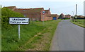
Area Overview for Laneham
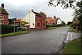
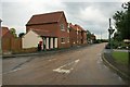
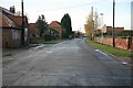
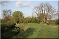
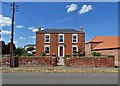
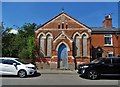
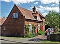
Photos of Laneham
Area Information
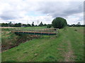
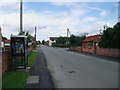
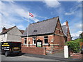
Living in Laneham feels like settling into a quiet, established enclave within the English countryside. This civil parish covers an area of just 6.6 square kilometres, creating a compact living environment where daily routines are familiar and straightforward. You are stepping away from the bustle of larger urban centres into a setting defined by long-term residency and deep local roots. The atmosphere here revolves around stability, with a population that has likely lived in similar patterns for generations. There are no grand commercial districts or crowded main streets within these boundaries, meaning your week is defined by the rhythms of the village rather than urban fast pace. Every day looks similar, offering a predictable lifestyle suitable for those who value consistency over constant novelty. You will find neighbours who know each other and a community that functions on understated, practical levels. Buying a home here means accepting a life of simplicity and continuity. The small physical size of the parish ensures that distances are short, making travel between your home and local amenities a matter of minutes. This lack of sprawl creates a tight-knit feel where the boundary between private residence and public space is clear. Residents here move slowly and appreciate their surroundings, which means your experience of Laneham will be one of peace and unobtrusive living.
- Area Type
- Parish
- Area Size
- 6.6 km²
- Population
- Not available
- Population Density
- Not available
Demographics
The community in Laneham is defined by an exceptionally mature population structure. The median age of residents stands at 70 years, indicating that this parish is a retirement destination or a place where older generations remain throughout their lives. The most common age range skews significantly towards seniors, meaning you are entering a community dominated by older adults rather than families with young children. This demographic profile shapes the local culture and services available. Home ownership is extremely high, with 84% of the population owning their property outright or with a mortgage. Such a statistic suggests a market that values long-term commitment and stability over rental mobility. Household composition will reflect this demographic, with many homes occupied by couples nearing the end of their lives or single elderly residents. There are no major ethnic or religious statistics provided to break down the community further, so you should expect a generally homogeneous and settled population. This lack of rapid demographic change means the social fabric remains static and traditional. When you move here, you join a group where people have lived for decades and are unlikely to leave quickly. The elderly median age and high ownership rates combine to create an environment where quiet contemplation and established routines are the norm.
Household Size
Accommodation Type
Tenure
Ethnic Group
Religion
Household Composition
Age
Household Deprivation
NS-SEC
Explore more demographic insights in this area
Go to Demographics tabPlanning
Planning Constraints
- Flood RiskPremium
- Ramsar Wetland SitesPremium
- Area of Outstanding Natural BeautyPremium
- Protected Nature ReservePremium
- Protected WoodlandPremium
- Crime RiskPremium