Area Overview for Lady Bay Ward
Photos of Lady Bay Ward
Area Information
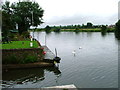
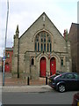
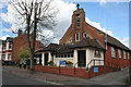
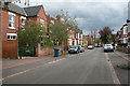
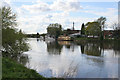
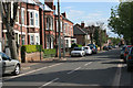
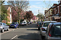
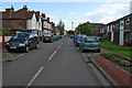
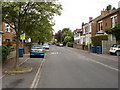
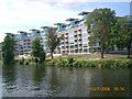
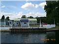
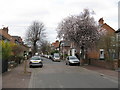
Lady Bay Ward occupies a distinct residential space within West Bridgford, covering an area of 1.4 square kilometres in Nottinghamshire. This ward sits on the east side of the town, located between the River Trent to the north and the disused Grantham Canal to the south. Its specific boundaries create a unique geography defined by these waterways, marking it as a historic pocket of the East Midlands region. The area's name dates back to at least 1613, with origins potentially linked to local religious history or a former creek. Development began over a century ago when house builders transformed former farmland, establishing a community that retains a notable historical character. You will find significant landmarks such as All Hallows Church on Pierrepont Road and Lady Bay Bridge, which connects the ward to Nottingham across the river. Living in Lady Bay Ward offers a home situated in a location with clear geographical markers and immediate access to the city. The ward became a separate parish in 1950, cementing its status as an established community rather than a modern satellite development. Prospective buyers looking for homes in Lady Bay Ward are entering a market defined by its specific location and deep historical roots. The area remains one of the smaller wards in the district, concentrating its residents into a defined neighbourhood with its own identity.
- Area Type
- District Borough Unitary Ward
- Area Size
- 1.4 km²
- Population
- Not available
- Population Density
- Not available
Demographics
The community profile of Lady Bay Ward reveals a very mature population, with a median age of 70. This indicates that the area is populated predominantly by older residents who may be retiring or already retired. You will find that the typical household composition reflects an older demographic structure compared to the national average. Home ownership stands at 78 per cent, which is significantly higher than most other urban areas and suggests a stable community where people have lived for the long term. The high level of ownership implies that many residents bought their homes before the price surges of recent decades. Accommodation types in the ward generally suit the needs of an older population, likely consisting of large, freehold or leasehold properties rather than purpose-built rentals. There is no significant data available on ethnic diversity or religious breakdown within the provided figures, so the community appears demographically stable across other lines. For those considering living in Lady Bay Ward, the dominant age profile means you will engage with a settled population that values local continuity. The area is not designed for young families seeking entry-level housing, but rather for those established in their careers or retirement. Deprivation levels are not quantified in the current dataset, but the high ownership rates suggest a relatively affluent and secure group of inhabitants.
Household Size
Accommodation Type
Tenure
Ethnic Group
Religion
Household Composition
Age
Household Deprivation
NS-SEC
Explore more demographic insights in this area
Go to Demographics tabPlanning
Planning Constraints
- Flood RiskPremium
- Ramsar Wetland SitesPremium
- Area of Outstanding Natural BeautyPremium
- Protected Nature ReservePremium
- Protected WoodlandPremium
- Crime RiskPremium