Area Overview for Knossington and Cold Overton
Photos of Knossington and Cold Overton


Area Information
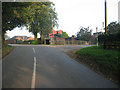
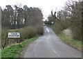
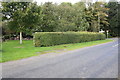
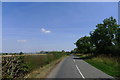
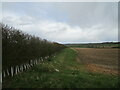
Knossington and Cold Overton is a distinct civil parish covering an area of 12.9 km² in England. This community offers a settled environment where daily life revolves around local rhythms rather than urban rushes. You will find a neighbourhood defined by its stable character, where residents enjoy a clear separation between work and private life. The parish stands apart from bustling town centres, providing a backdrop for those seeking a quieter existence without leaving the county. Living in Knossington and Cold Overton means embracing a lifestyle where the pace is governed by the seasons and community needs. The size of the parish suggests a manageable scale, allowing neighbours to potentially know each other by sight. While the area lacks the density of major hubs, it functions as a self-contained unit for its inhabitants. Homes here serve as long-term residences, reflecting the intended permanence of life in this specific locale. The physical boundaries of the parish encompass both Knossington and Cold Overton, creating a unified local identity for anyone choosing this spot to put down roots. Your time spent in this parish will likely be defined by proximity to familiar landmarks and a deep connection to the immediate surroundings.
- Area Type
- Parish
- Area Size
- 12.9 km²
- Population
- Not available
- Population Density
- Not available
Demographics
The community within Knossington and Cold Overton reflects a mature population profile. The median age here is 70 years old, indicating that the vast majority of residents fall into older age brackets. Age: Total serves as the baseline for understanding that most households comprise individuals or couples who have already reached a later stage of life. You should expect a neighbourhood where active retirees and those seeking a calm environment form the core demographic. Home ownership stands at a high level of 78%, which signals that most people reside in properties they directly own rather than renting. This statistic underscores a culture of stability, where families build equity and stay within the parish for generations. The household composition totals the entire population, revealing that single-occupancy or couple-based homes dominate the landscape. Accommodation type data shows that the stock is tailored for established residents, consistent with the high ownership rate. Predominant ethnic group and religion details round out the social fabric, though the defining feature remains the age and ownership structure. Living here offers peace of mind alongside the financial security that accompanies widespread property ownership. The demographic reality is simple: this is an area for those who value quiet and established community ties.
Household Size
Accommodation Type
Tenure
Ethnic Group
Religion
Household Composition
Age
Household Deprivation
NS-SEC
Explore more demographic insights in this area
Go to Demographics tabPlanning
Planning Constraints
- Flood RiskPremium
- Ramsar Wetland SitesPremium
- Area of Outstanding Natural BeautyPremium
- Protected Nature ReservePremium
- Protected WoodlandPremium
- Crime RiskPremium