Area Overview for Knighton Ward
Photos of Knighton Ward
Area Information
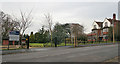
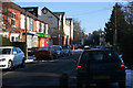
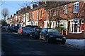
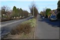
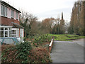
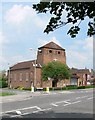
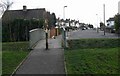
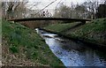
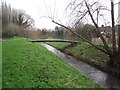
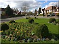
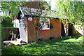
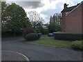
Knighton Ward sits south of Leicester city centre within the unitary authority of Leicester City Council. This electoral ward covers approximately 4.2 km² and serves a population of 5,973 residents. The area primarily incorporates the suburb of West Knighton, with boundaries stretching from Knighton Fields Road to the north down to the city boundary in the south. Much of the locality developed during the 1950s, resulting in a suburban character defined by semi-detached and detached housing alongside council allotments. You will find significant green open spaces at Knighton Park, which occupies the southern boundary of the ward. The presence of these parks and the layout of the homes suggest a community focused on residential stability rather than high-density living. Living in Knighton Ward means being situated in a district shaped by mid-century planning. The ward's coordinates align closely with West Knighton, placing you within a defined pocket of the East Midlands region. While specific retail hubs or commercial centres are not detailed in local records, the area's structure points towards a quiet, established neighbourhood. Residents enjoy proximity to Knigton Fields Road and are bordered to the east by Welford Road, a major thoroughfare linking the area to the wider region. The combination of post-war housing and access to green spaces creates a distinct environment for families and individuals seeking a suburban lifestyle away from the urban core.
- Area Type
- District Borough Unitary Ward
- Area Size
- 4.2 km²
- Population
- 5973
- Population Density
- 1428 people/km²
Demographics
The community profile of Knighton Ward reflects a mature demographic structure. The median age for residents is 70 years, which is significantly higher than the national average. This figure indicates that the ward has a population skewed heavily towards older adults. Data confirms that the most common age range measured is simply 'Age: Total', suggesting the population lacks the mix of younger families or young professionals often found in other urban districts. You must consider this age profile when evaluating the local vibe, as the neighbourhood is dominated by retirees. Home ownership stands at 73% within Knighton Ward, meaning the vast majority of people living here own their properties outright or have a mortgage. This high rate of ownership correlates with the older age demographic and the stock of semi-detached and detached homes built in the 1950s. Households in this ward are predominantly owner-occupied rather than rental units. There is no data provided regarding specific ethnic group breakdowns, religious affiliations, or detailed household composition percentages. Consequently, the available figures suggest a homogenous, locally settled community where long-term residents are the norm. The sheer concentration of older, owner-occupied homes defines the social fabric of this specific ward.
Household Size
Accommodation Type
Tenure
Ethnic Group
Religion
Household Composition
Age
Household Deprivation
NS-SEC
Explore more demographic insights in this area
Go to Demographics tabPlanning
Planning Constraints
- Flood RiskPremium
- Ramsar Wetland SitesPremium
- Area of Outstanding Natural BeautyPremium
- Protected Nature ReservePremium
- Protected WoodlandPremium
- Crime RiskPremium