Area Overview for Kirton and Frampton Ward
Photos of Kirton and Frampton Ward
Area Information
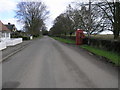
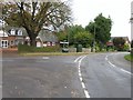
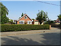
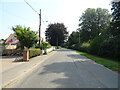
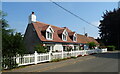
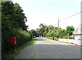
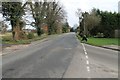
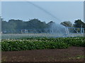
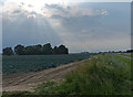
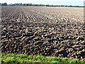
Living in Kirton and Frampton Ward offers a distinctly rural experience within the Borough of Boston, Lincolnshire. This electoral ward covers an area of 54.5 km² and encompasses the historic civil parishes of Kirton and Frampton. You are situated a short distance south of Boston, with the A16 road running nearby and providing direct access to the county town. The landscape is defined by its connection to the historic Lincolnshire Loop Line, which once ran through Kirton until the service closed in 1961 or 1964. Today, the trackbed of this former railway has been absorbed into the existing road network, shaping the current street pattern of the area. The town of Kirton sits at approximately 52.93°N, 0.05°W, anchoring the community in the East Midlands region. Governance for the area was formalised in 1974 under the Local Government Act 1972, creating Kirton parish as its own electoral ward. While you lose the buzz of a major city centre, you gain immediate access to local history. The ward features landmarks such as the Kirton Grammar School, founded in 1624 under the Endowed Schools Act 1869, and the remnants of Kirton Meres ancient manor, where the arched gatehouse survived until 1925. If you are considering homes near Kirton or Frampton, you will find a settlement built around these deep historical roots rather than modern commercial hubs.
- Area Type
- District Borough Unitary Ward
- Area Size
- 54.5 km²
- Population
- Not available
- Population Density
- Not available
Demographics
The community in Kirton and Frampton Ward has a distinctly older population profile compared to the national average. Approximately 66% of households in the ward own their homes outright, indicating a strong commitment to established property tenure among residents. The demographic data shows a median age of exactly 70 years, which suggests the area serves as a major retirement destination. You will find that the majority of people living in this ward fall into the older age bracket, making it suitable for retirees but potentially less ideal for families with young children seeking active schools. Household composition and accommodation types in Kirton and Frampton Ward reflect an area designed for smaller, self-contained households typical of retirement living. There is no significant data provided on specific ethnic diversity or religious breakdown, so you should assume a populace that reflects the traditional, long-standing communities of the wider Lincolnshire region. While specific deprivation statistics are not included in the current dataset, the high home ownership rate often correlates with financial stability among senior citizens. When researching schools near Kirton and Frampton, note that the dominant demographic suggests a lower demand for infant and primary school places compared to younger demographics. Your daily life here is likely dominated by retirees, with a quiet pace that aligns with a population where 70 years is the median age.
Household Size
Accommodation Type
Tenure
Ethnic Group
Religion
Household Composition
Age
Household Deprivation
NS-SEC
Explore more demographic insights in this area
Go to Demographics tabPlanning
Planning Constraints
- Flood RiskPremium
- Ramsar Wetland SitesPremium
- Area of Outstanding Natural BeautyPremium
- Protected Nature ReservePremium
- Protected WoodlandPremium
- Crime RiskPremium