Area Overview for Kirton
Photos of Kirton
Area Information
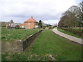
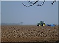
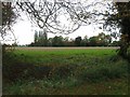
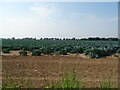
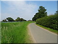
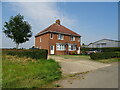
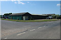
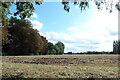
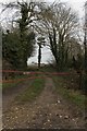
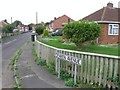
Living in Kirton offers a distinctly rural lifestyle within a civil parish spanning 31.9 km² of north Lincolnshire. The area is defined by its large geographical footprint and tranquil countryside setting rather than dense urban development. You are entering a community where space is abundant and the pace of life is slow. This parish provides a stark contrast to busy city centres, prioritising quiet streets and open skies over commercial vibrancy. The landscape is vast, which naturally limits the volume of daily foot traffic but ensures privacy for residents choosing homes here. Daily life revolves around local amenities and the surrounding countryside, offering a retreat from the noise of larger population hubs. Prospective buyers will find Kirton suitable if they value extensive green spaces and seclusion. The area does not support the night-time economy or busy retail parks typical of larger towns, placing all commerce and services at a distance or in nearby hubs. Your morning routine might involve traversing significant distances to reach major centres, but your homebase remains a secluded sanctuary. The 31.9 km² size means travel times within the parish can be short, yet reaching wider infrastructure requires a vehicle. Living in Kirton is a commitment to a car-dependent existence where freedom of movement is tied to road travel rather than public transit. The character of the parish is established by its historical status as a civil community, reflecting centuries of agricultural continuity. There are no sudden transitions from industrial zones to residential homes; the boundary between land use is defined by the natural topography. You will experience a neighbourhood where silence is the primary soundtrack, punctuated only by local wildlife and distant traffic. This environment demands independence and self-sufficiency, making it an ideal location for those who have already established their priorities around property ownership and quietude.
- Area Type
- Parish
- Area Size
- 31.9 km²
- Population
- Not available
- Population Density
- Not available
Demographics
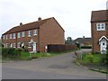
The community in Kirton reflects a mature population, with a median age of 70 years. This demographic profile indicates that the neighbourhood is dominated by older residents, likely former homeowners or those seeking retirement in a quiet setting. The age data suggests a population with extensive life experience and stable living arrangements, differing significantly from younger, transient urban districts. Families with young children are a minority presence, aligning with the high concentration of elderly demographics. This structural reality shapes the local economy, favouring services catering to older adults such as healthcare support, leisure activities, and quiet community spaces. Large portions of the parish are occupied by permanent residents, evidenced by a home ownership rate of 66%. This high level of tenure stability means the local culture fosters long-term relationships and deep community roots. Renters form a smaller segment of the population, reinforcing the character of a place where people stay for decades rather than years. The household composition is weighted towards individuals or small families, consistent with the median age statistic. You will encounter neighbours who have lived in their properties for generations, creating a reputation for established local governance and civic participation. The area's demographics also inform its social dynamics. With a median age of 70, social activities will centre on gatherings suitable for mature groups. Public services must adapt to this reality, ensuring that healthcare facilities and transport links remain accessible. The 66% ownership rate further underscores the financial security of the population, as most residents have purchased their properties rather than relying on social housing. This economic stability contributes to a calm social environment, reducing the churn often found in student-heavy or rental-dominated neighbourhoods. Living in Kirton means joining a community where age is a shared identifier and stability is the norm.
Household Size
Accommodation Type
Tenure
Ethnic Group
Religion
Household Composition
Age
Household Deprivation
NS-SEC
Explore more demographic insights in this area
Go to Demographics tabPlanning
Planning Constraints
- Flood RiskPremium
- Ramsar Wetland SitesPremium
- Area of Outstanding Natural BeautyPremium
- Protected Nature ReservePremium
- Protected WoodlandPremium
- Crime RiskPremium