Area Overview for Kirklington
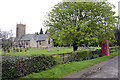
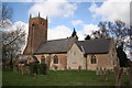
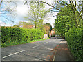
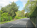
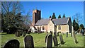
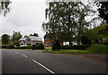
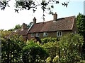
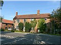
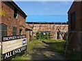
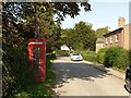
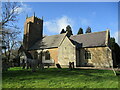
Photos of Kirklington

Area Information
Living in Kirklington means residing in a compact built-up area covering 37.8 hectares within Nottinghamshire. As a small town, the environment feels intimate rather than sprawling, offering a resident-focused atmosphere distinct from larger urban centres. You will find that daily life revolves around close proximity to local hubs, creating a routine where essential services are within practical walking or short driving distance. The area is characterised by a steady pace, ideal for those prioritising a grounded community setting over metropolitan energy. The character of this neighbourhood is defined by its scale and the way it integrates with the surrounding countryside. You are living in a place where the boundaries of the built environment do not extend far beyond the immediate town limits. This constraint on size often results in quieter streets and less traffic congestion compared to nearby larger towns. For anyone considering homes in Kirklington, the primary appeal lies in this manageable footprint. It represents a option for those who want a established community without the密度 of a major city. When you think about your future home, you are buying into an area with a clear identity. The layout supports a lifestyle where neighbours know one another, and local institutions hold significant weight in community life. This setting suits retirees, families seeking stability, and professionals who value low-key living. You are looking at an area where the built fabric is mature, providing a sense of permanence and established infrastructure. Every aspect of daily living here is shaped by these geographical boundaries and the resulting local culture.
- Area Type
- Built Up Area 250
- Area Size
- 37.8 hectares
- Population
- Not available
- Population Density
- Not available
Your daily lifestyle in Kirklington is supported by a compact array of amenities within practical reach. Retail options are limited but functional, with five main shops serving your needs. You will likely visit Co-op Farnsfield, Morrisons Daily, and Co-op Southwell for your essential grocery shopping and daily necessities. These five venues form the core of your local high street, providing enough variety for basic requirements without the overwhelming choice of a city centre. For those requiring further travel, the rail network mentioned earlier offers additional connectivity beyond local shops. The presence of wholesale clubs like Morrisons helps mitigate the lack of extensive retail diversity. You do not live in an area designed for luxury or extensive dining, but rather for convenience and necessity. The character of these amenities suggests a self-sufficient community where residents handle most daily tasks locally. Parks and large leisure facilities are not explicitly listed in the immediate vicinity data, focusing the area's identity on its retail and transport links. This concentration of amenities creates a lifestyle where errands are clustered efficiently. You spend less time commuting to taxis for essentials and more time within immediate proximity of your home. This practicality defines the rhythm of life here, favouring efficiency and routine. Living in Kirklington means accepting a straightforward, uncluttered approach to services and leisure.
Amenities
Schools
Families considering spending time in Kirklington have access to several educational institutions nearby. The most prominent local facility is Kirklington Primary School, which holds a good Ofsted rating. This school serves the immediate neighbourhood catchment area and provides early education for younger children. Its good rating offers reassurance regarding the quality of basic education available to residents of the town. Beyond the local primary setting, Rodney School is situated nearby as an independent institution. This option provides an alternative pathway for families seeking a different educational environment outside the state system. For children with specific educational needs, Wings School Notts is a notable nearby option, also carrying a good Ofsted rating. This special school offers tailored support within the regional education framework. The mix of school types available reflects the demographic reality of the area. While the primary school serves local children, the presence of independent and special needs schools indicates a broader educational landscape within reach. If you are looking at schools near Kirklington, you will find a choice that accommodates various educational preferences. You should note that these institutions are all located within a practical distance for families living in the area. The combination of a local state primary with nearby independent and special provisions creates a versatile network for student education.
| Rank | A + A* % | School | Type | Entry gender | Ages |
|---|---|---|---|---|---|
| 1 | N/A | Kirklington Primary School | primary | N/A | N/A |
| 2 | N/A | Rodney School | independent | N/A | N/A |
| 3 | N/A | Wings School Notts | special | N/A | N/A |
Explore more schools in this area
Go to Schools tabDemographics
The community in Kirklington is defined by an exceptionally older population structure. The median age sits at 70 years, which indicates that the area is predominantly comprised of older residents. This demographic profile shapes the character of the neighbourhood, influencing local services and the general pace of life you might expect. You will likely encounter a community where many households include retired individuals rather than young families or professionals in their prime earning years. Home ownership remains the primary form of tenure in this location. An impressive 84% of residents own their homes outright or with a mortgage, reflecting a community with deep local roots. This high rate of ownership suggests that investment in the property market has been sustained over a long period. You can expect few private landlords compared to owner-occupiers, which often creates a more stable environment for tenants and neighbours alike. The majority of accommodation types reflect this achievement, with single households and settled families forming the core of the neighbourhood. While the data does not explicitly breakdown ethnic groups or religious affiliations, the dominant profile remains consistent with national trends for retirement areas. The concentration of older residents means that the community has specific needs and lifestyle requirements that differ from younger urban centres. When you look at household composition, the pattern aligns with a settled population. This stability contributes to the quiet nature of the area. Living in Kirklington means joining a community where long-term residents have shaped the social fabric for generations. You are entering a space where tradition and stability are the defining features of social interaction.
Household Size
Accommodation Type
Tenure
Ethnic Group
Religion
Household Composition
Age
Household Deprivation
NS-SEC
Explore more demographic insights in this area
Go to Demographics tabPlanning
Planning Constraints
- Crime RiskLocked