Area Overview for Kirkby la Thorpe & South Kyme Ward
Photos of Kirkby la Thorpe & South Kyme Ward

Area Information
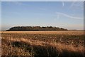
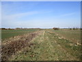
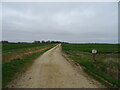
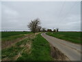
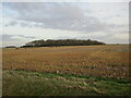
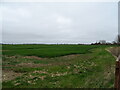
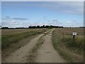
Kirkby la Thorpe and South Kyme Ward sits in North Kesteven, covering 67.6 square kilometres in the East Midlands. The population stood at 2,157 in 2021, clustered primarily around the village of Kirkby la Thorpe. This settlement dates back to the Domesday Book and lies roughly 2.4 kilometres east of Sleaford. The ward is positioned near the A17 Sleaford bypass, providing a strategic location for those needing road access while enjoying rural surroundings. Historical records from 1870 describe the parish as lying adjacent to the Grantham and Boston railway line. Your typical day here likely involves quiet streets lined with listed buildings, such as the Grade II* Church of St Denys and The Grange. The area comprises a mix of historic farmhouses and cottages, including early 17th-century properties on Mount Lane. Life here moves at a deliberate pace, away from major urban congestion yet within commuting distance of larger towns. Residents enjoy proximity to近代 amenities like The Queens Head public house without the noise of city living. The ward offers a substantial footprint for green spaces, ensuring ample room for outdoor activities despite its small population. This setting suits those seeking a established community with deep historical roots and a connection to the countryside.
- Area Type
- District Borough Unitary Ward
- Area Size
- 67.6 km²
- Population
- Not available
- Population Density
- Not available
Demographics
The community in Kirkby la Thorpe and South Kyme Ward is distinctly mature. The median age for residents is 70, indicating a population skewed heavily towards older adults. Demographic data confirms that the 'Total' age range is the most common category, reflecting this shift away from younger generations. Home ownership is the standard arrangement, with 76% of households owning their homes outright or with a mortgage. This high rate suggests a stable resident base rather than a transient rental population. Accommodation types and ethnic diversity data are recorded as totals, implying a homogeneous demographic profile consistent with many rural Lincolnshire villages. The area does not exhibit data for specific household compositions or predominant ethnic groups beyond these aggregate figures, pointing to a settled, traditional community structure. There is no indication of significant deprivation metrics in the available records, which often correlates with stable, lower-density rural wards. The absence of young families in the demographic breakdown explains why amenities cater to an older demographic, focusing on community hubs rather than youth-oriented services. This age profile means local businesses and services are likely tailored to the practical needs of seniors.
Household Size
Accommodation Type
Tenure
Ethnic Group
Religion
Household Composition
Age
Household Deprivation
NS-SEC
Explore more demographic insights in this area
Go to Demographics tabPlanning
Planning Constraints
- Flood RiskPremium
- Ramsar Wetland SitesPremium
- Area of Outstanding Natural BeautyPremium
- Protected Nature ReservePremium
- Protected WoodlandPremium
- Crime RiskPremium